Geospatial Services
Geographic Information Systems (GIS) offer powerful analysis tools and techniques that can be applied to a wide range of projects. Recognizing the value of this technology, Kimley-Horn has multidisciplinary teams of GIS professionals that offer these services to both public and private sector clients.
Kimley-Horn’s team of GIS professionals is unparalleled in both experience and capabilities. We specialize in integrating technology and GIS/Geospatial Services into planning, engineering, asset management, and environmental projects, ensuring standardized methodologies and defensible results.
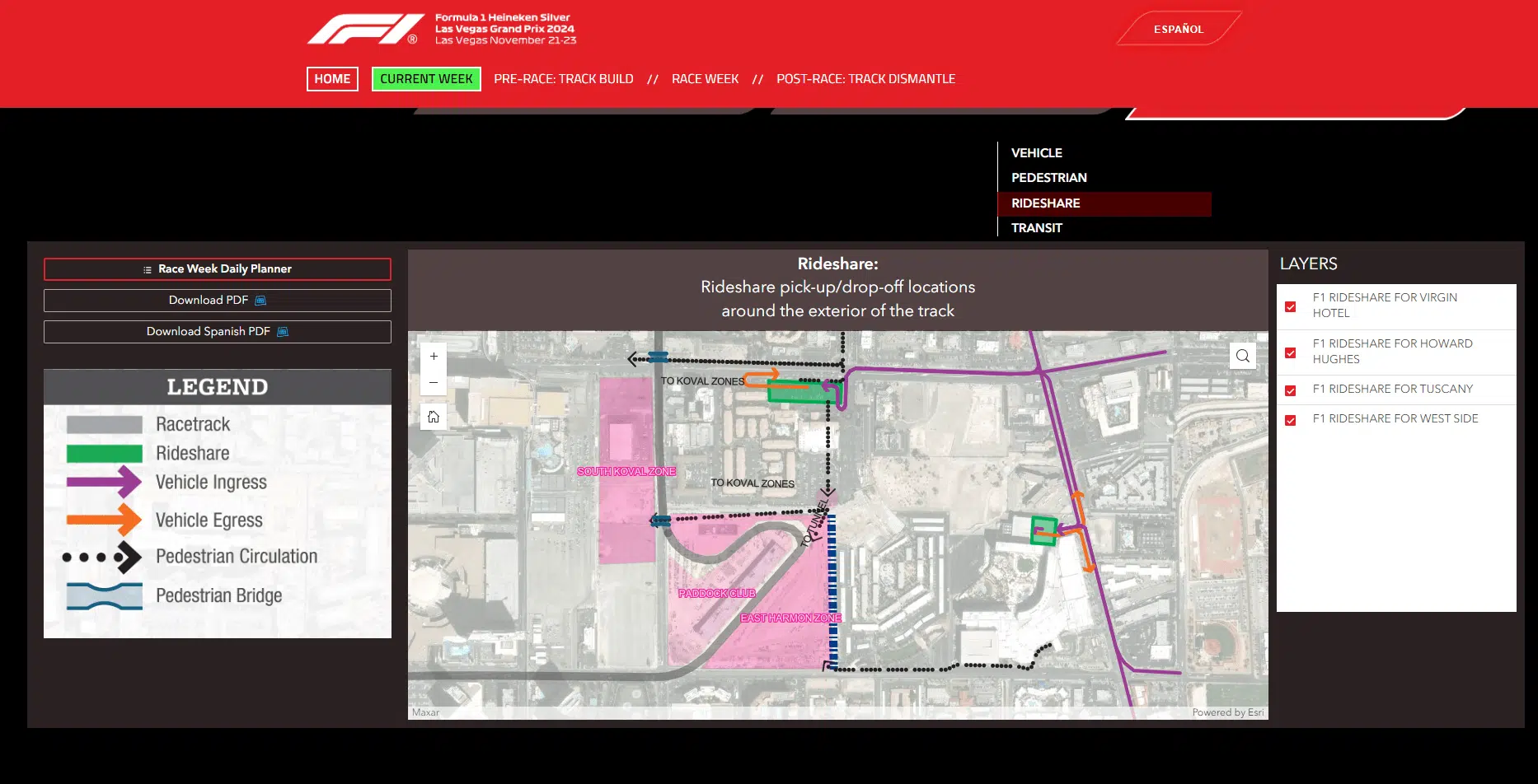
Kimley-Horn is an Esri Silver Level Business Partner and utilizes an Esri-based GIS platform to integrate with software tools and applications, including AutoCAD, Civil 3D, Adobe products, and other design software. We support the standardization and management of spatial data, user training, and the installation of GIS systems at client facilities. Additionally, our team’s expertise extends beyond GIS technology, encompassing areas such as graphic design and visualization, 3D model development, digital and thematic storytelling, and programming/automation.
![]()
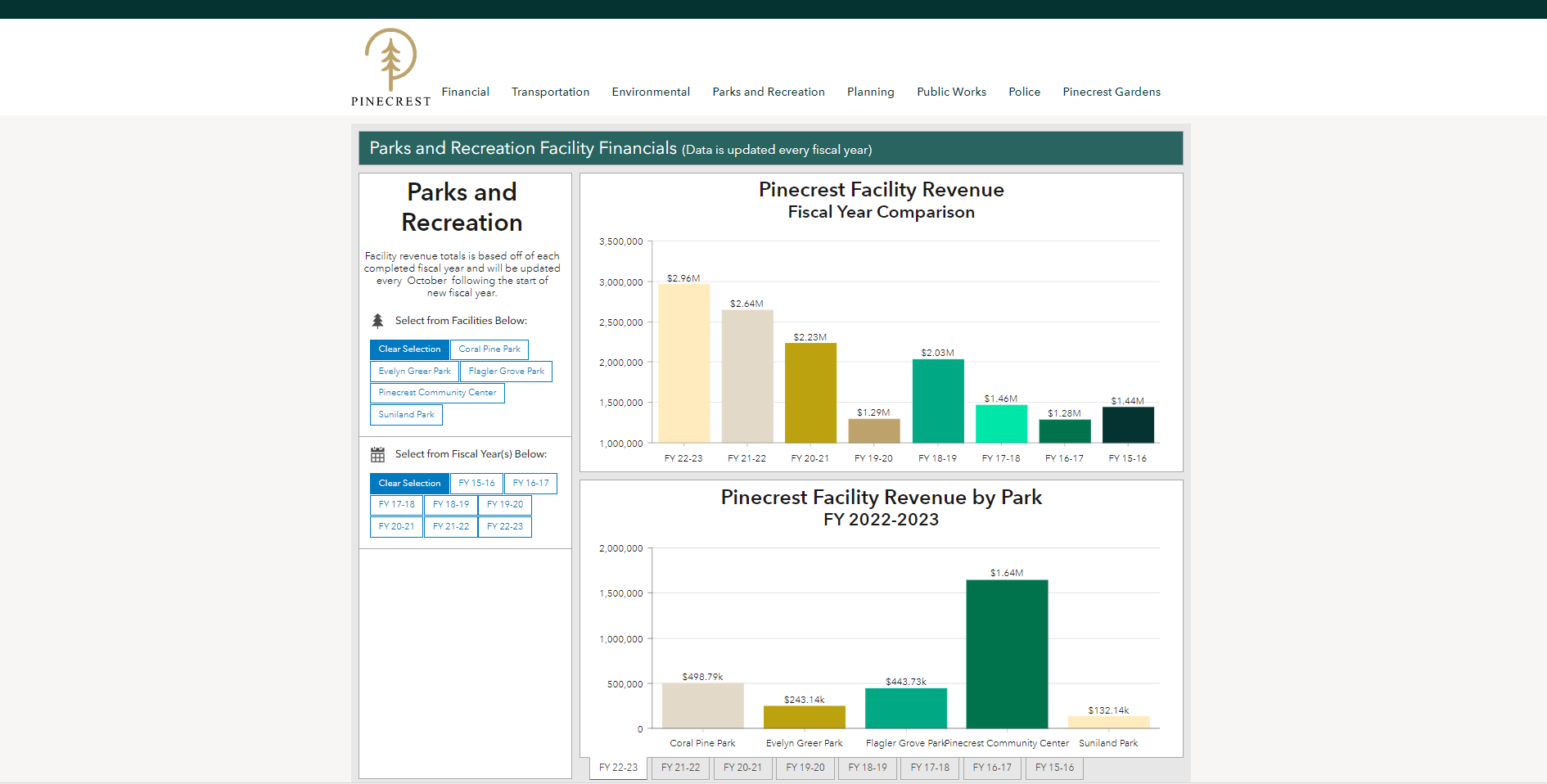
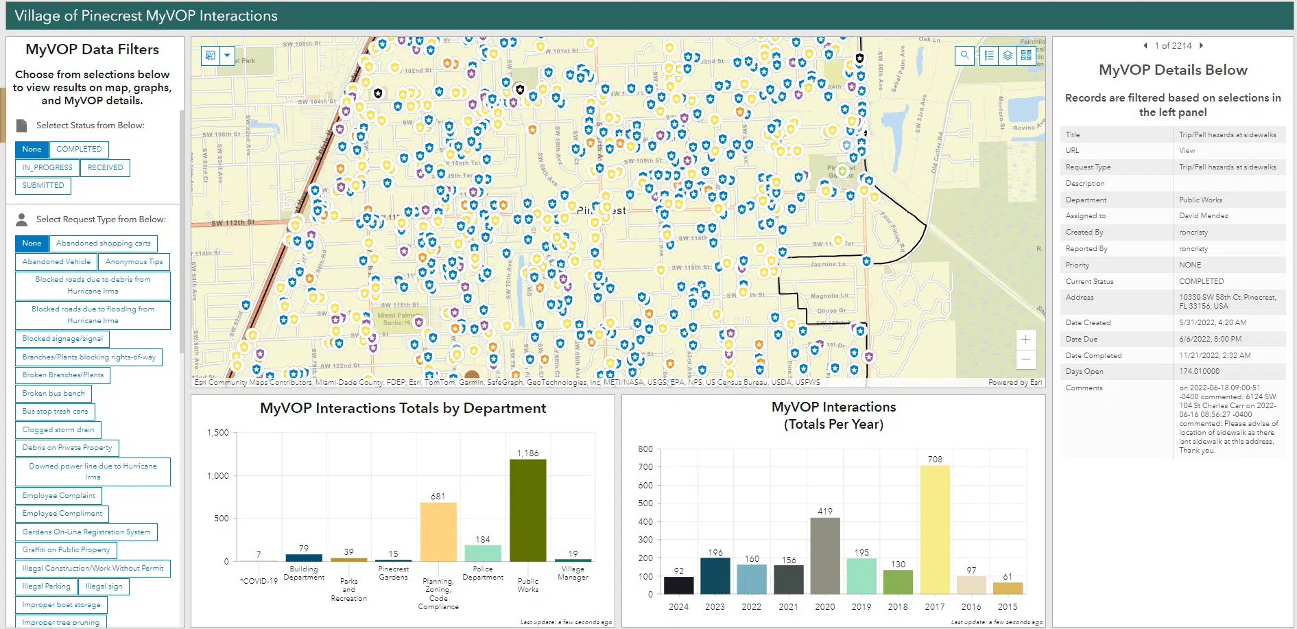
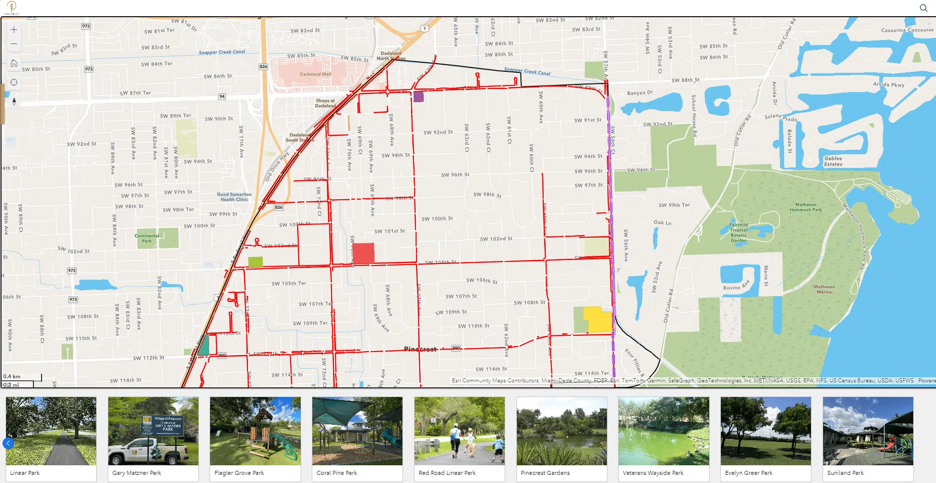
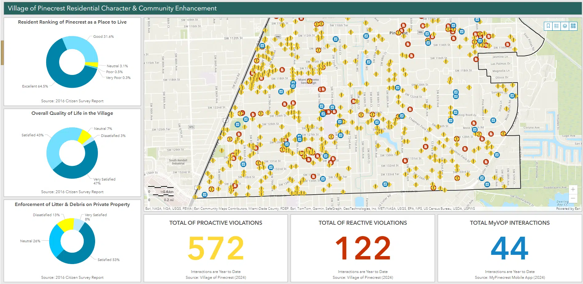
GIS Support for Local Governments
Kimley-Horn has a team of dedicated GIS consultants and IT personnel that provides ongoing technical support to local government agencies. Our support services have included making minor remote data revisions and updates, managing and hosting an agency’s GIS, and setting up an agency’s full ArcGIS Online or Enterprise services. Our team provides both in-house and remote support and works collaboratively with your GIS and IT teams as an staff.
Kimley-Horn Technology Solutions
Projects & Case Studies


News & Insights