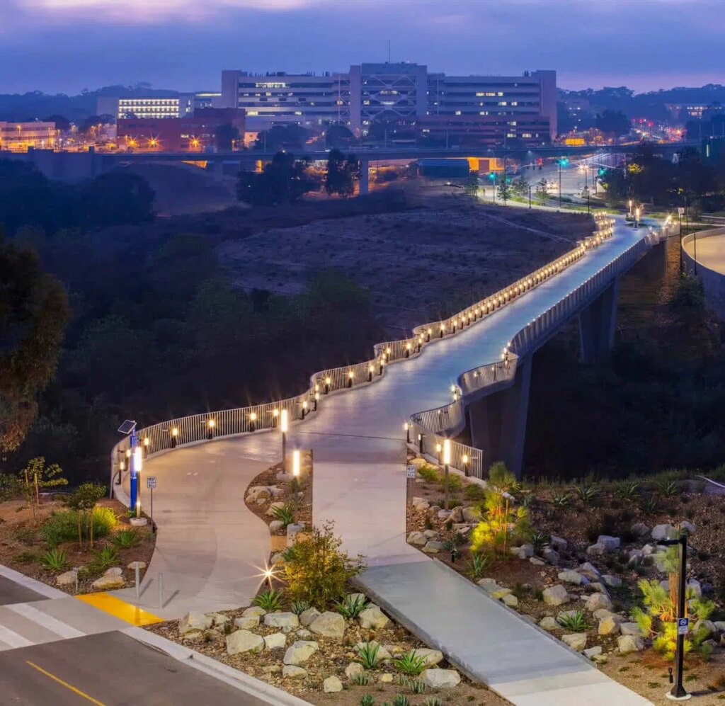
Bob Callan Multiuse Trail Phase II, Segment A
The Bob Callan Multiuse Trail Phase II, Segment A project uniquely combines safety, sustainability, and accessibility, allowing users to experience a beautiful urban stream that was previously hidden to the public by surrounding commercial developments. Located near multiple businesses and multifamily residences, this project provides an access point to thousands in the Cumberland Community.
Overview
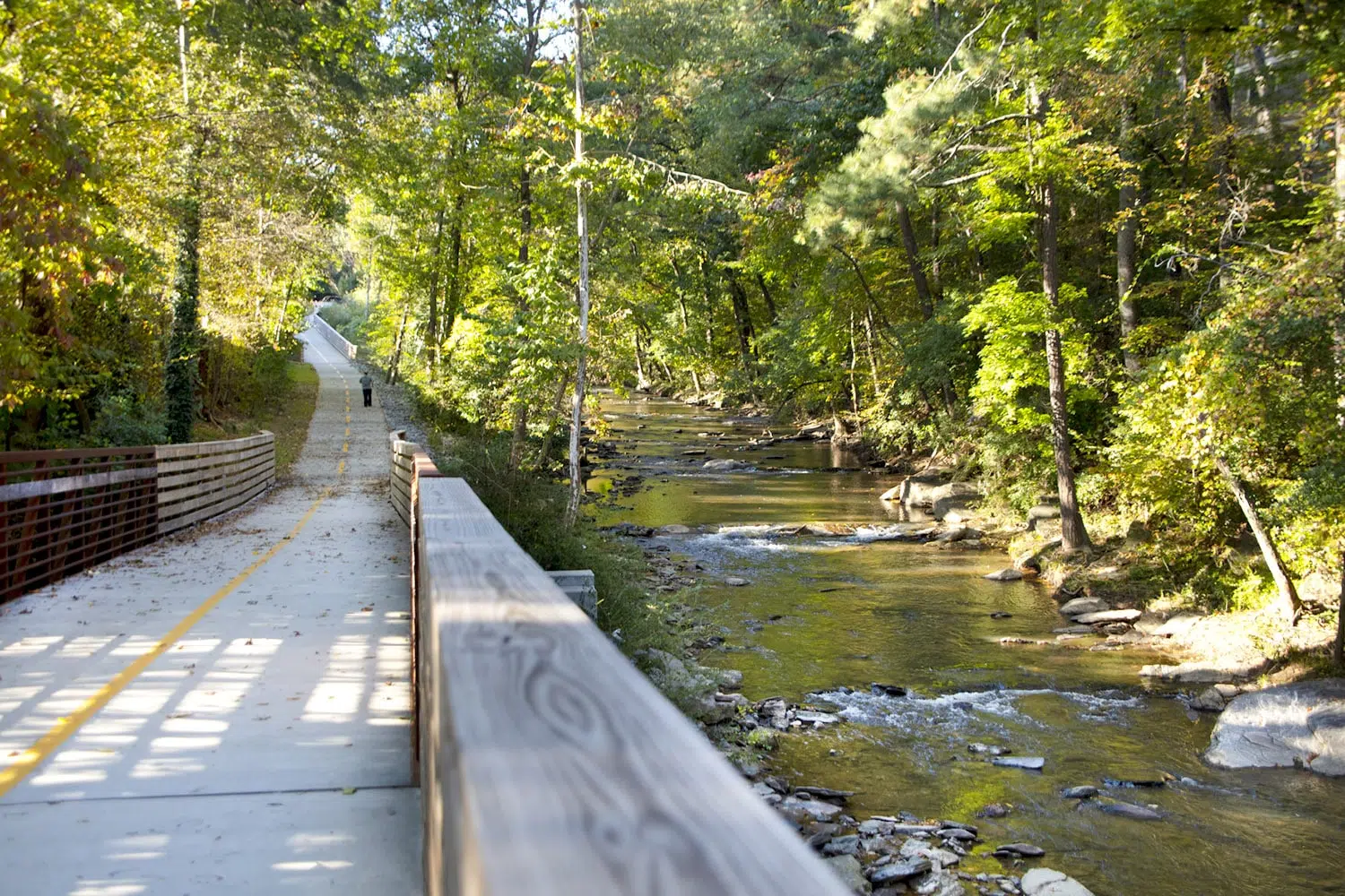
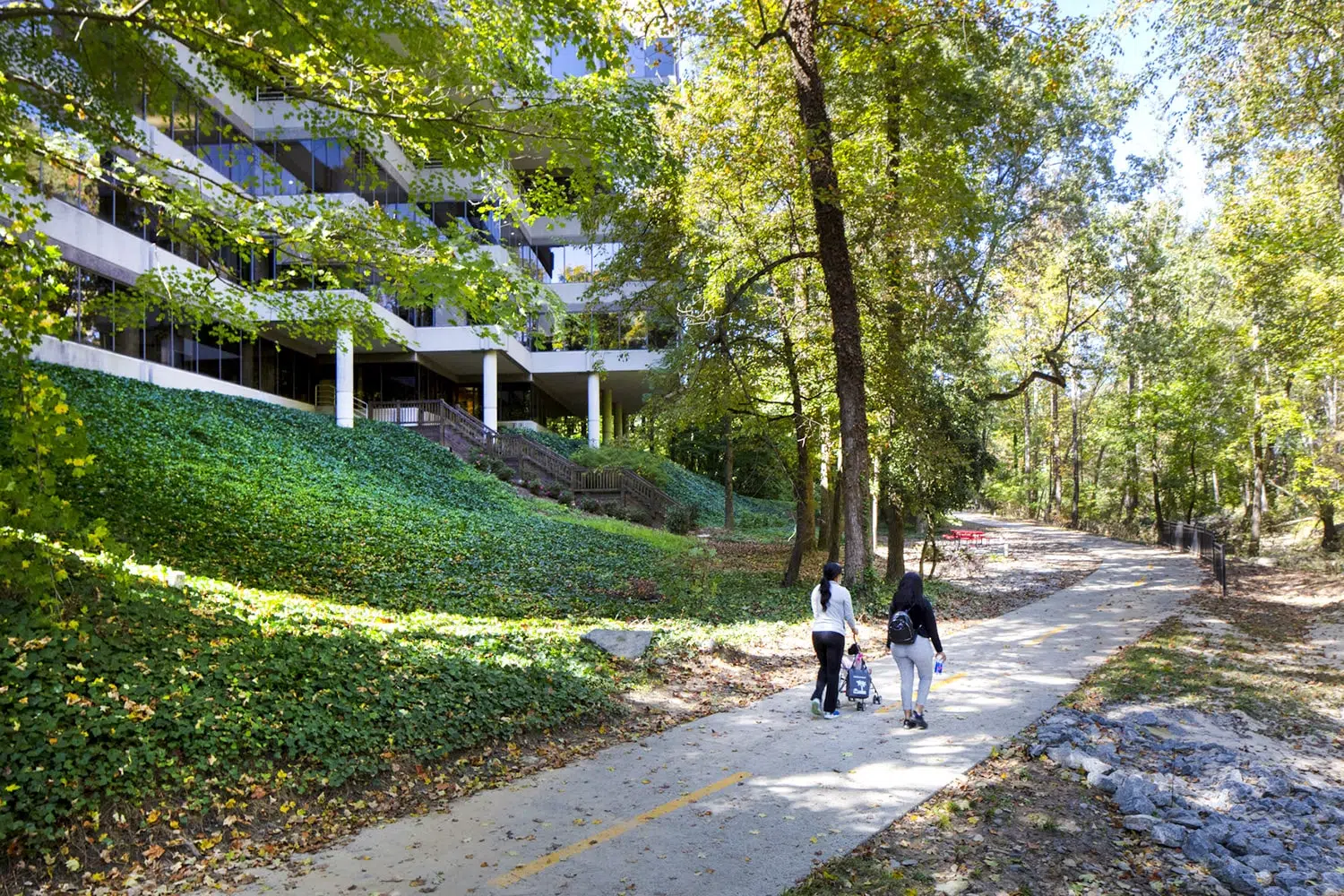
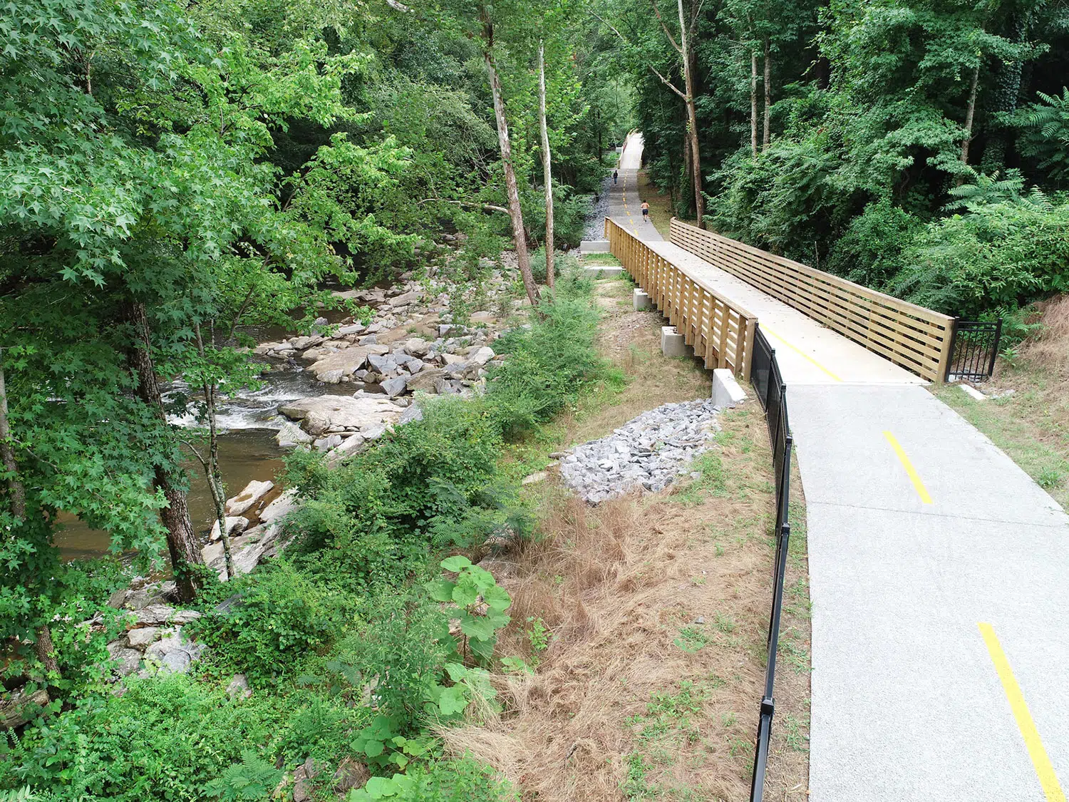
Kimley-Horn provided geometric roadway and structural design, FEMA floodplain coordination, and NEPA documentation for a one-mile extension of the Bob Callan Trail in Cobb County, Georgia. As an extension of the existing two-mile Bob Callan Trail managed by the Cumberland Community Improvement District (CID), this one-mile addition increases pedestrian and bicycle connectivity for the surrounding communities. In addition to uncovering a formerly hidden creek and creating a pedestrian refuge, the trail also provides a recreational amenity for the many residential neighborhoods surrounding the Chattahoochee River and Rottenwood Creek.
Designing for a Sustainable Future
Kimley-Horn was the prime design consultant for the one-mile extension of the Bob Callan Trail, providing concept development, environmental documentation, stream buffer permitting, construction plan preparation through the GDOT Plan Development Process, and a Conditional Letter of Map Revision. Kimley-Horn also worked with the Cumberland CID to obtain a Public Lands Highways Division grant, which helped fund right-of-way acquisition and construction costs.
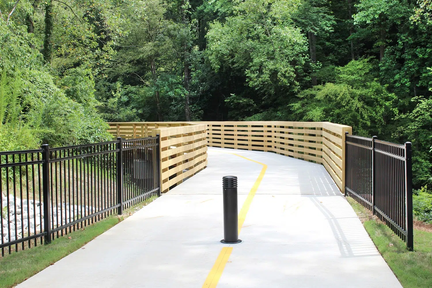
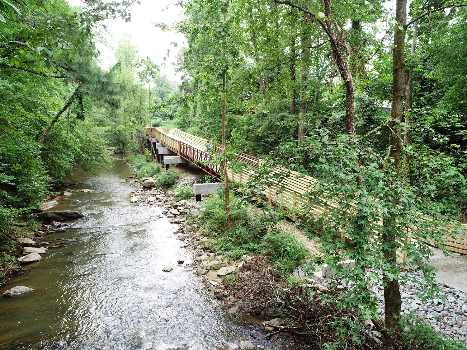
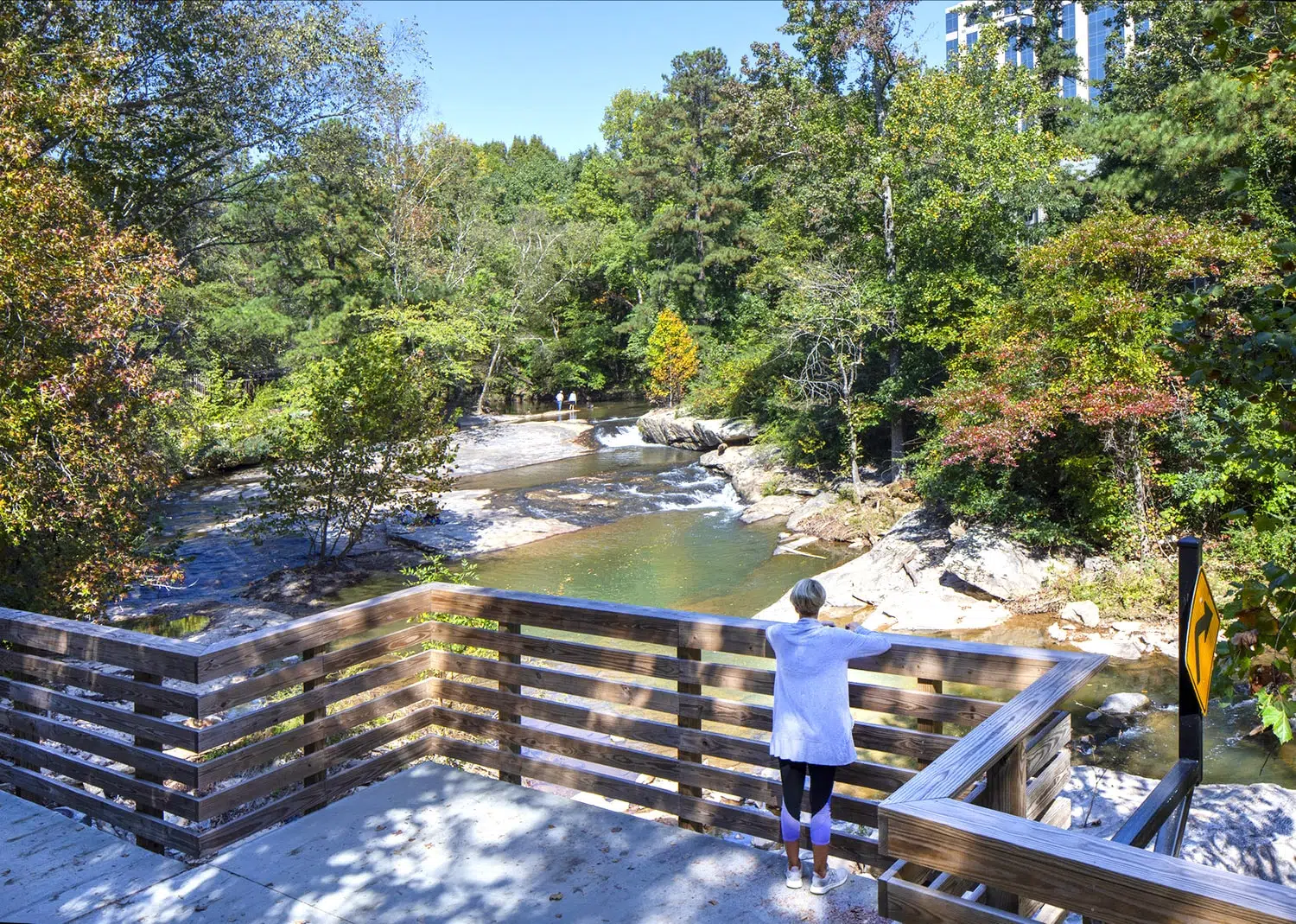
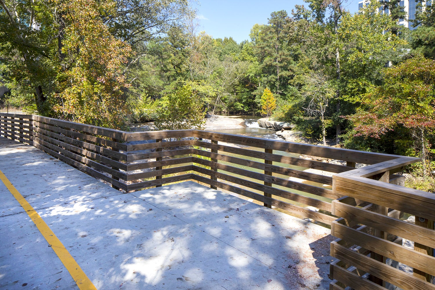
The trail has long sections of elevated structural boardwalk to avoid impacts to the Rottenwood Creek floodplain. Several scenic views of the creek and surrounding forest complement the trail and natural environment. The structural boardwalk, consisting mainly of steel and concrete elements for long-term durability and to reduce long-term maintenance costs, was planned and designed to coordinate with a sanitary sewer line that runs along the creek. The design includes sustainable design solutions such as open concrete paving to mitigate impacts to the Rottenwood Creek stream buffer and no net fill in the FEMA 100-year floodplain to mitigate impacts to adjacent and downstream properties. The Segment A northern trailhead was designed to accommodate future segments to the north, which ultimately will provide bicycle and pedestrian connectivity to communal and educational facilities. To the south, the segment will eventually connect with the Atlanta BeltLine.
Resolving Constructability Challenges
Constructed along Rottenwood Creek, the project faced multiple challenging constraints including a narrow floodplain, a thick, mature tree canopy, a Cobb County trunk line sewer, and an existing transcontinental gas pipeline. Kimley-Horn’s design used a combination of at-grade paved trail and elevated boardwalk to minimize fill in the floodplain and provide an accessible route through the steep, rocky terrain. The at-grade trail sections use pervious concrete pavement to minimize impacts within the stream buffer and reduce stormwater flows. A variety of foundation systems were also used to help the contractor adapt to unforeseen subsurface conditions during construction. Additionally, the trail was designed to allow for emergency access by Cobb County first responders per the American Association of State Highway and Transportation Officials (AASHTO) and Cobb County DOT requirements.
Innovating for Future Extensions
Maintaining a focus on public enjoyment, the trail accentuates and preserves the surrounding natural environment. As a trail extension, Segment A, Phase II of the Bob Callan Multiuse Trail is just one of the planned future extensions, which will provide miles of outdoor recreation and multimodal transportation options to the community.
The distinct approach to trail design through an at-grade trail with an elevated boardwalk exemplifies the trail segment as an answer to future design challenges. As paths for pedestrians and cyclists expand into major metropolitan and suburban areas—including redevelopment projects within Atlanta’s city center—so do their roles in multimodal transport. The project team’s solution for accessibility is a model not only for structural and geometric design of its project type, but also a solution for ease of maintenance and durability given its substructure.
Community Impact
This project extends the growing multiuse trail network and creates a true urban oasis for those who live and work in the Cumberland community. The trail segment weaves through the beautiful natural landscape and provides scenic overlooks at various points along the creek, allowing users to escape the city and enjoy the various rapids and scenery along Rottenwood Creek, all while enhancing the multimodal transportation network in Cobb County.
Project Recognition
Related Projects