Transit Planning with a Virtual Space for Public Involvement
Challenge
Solution
Impact
The Challenge
The Metropolitan Council in Minneapolis, Minnesota faced a barrier to effective community engagement when searching for an interactive online mapping tool.
The Metropolitan Council needed a solution that would both communicate complicated light rail design implications and allow community members to provide input on the light route and station locations while they navigated this process through the pandemic. With the help of Kimley-Horn, the Metropolitan Council and Hennepin County have been planning to design and construct an extension to the Blue Line, a light rail transit line proposed to go through Minneapolis, Crystal, Robbinsdale, and Brooklyn Park in Minnesota. Ensuring significant investment provides an equitable and reliable transportation option that also builds community wealth is important to the Metropolitan Council, so meaningful engagement with the communities they serve was a priority for the advancement of the Blue Line Extension.
The Metropolitan Council needed a new strategy to improve communication with the public and gather a large variety of input, promoting broader, more balanced feedback than they had seen with their previous engagement strategies. They required a solution that enabled them to share interactive geographic information with the public and allow for discussion about route options, station locations, and how the light rail would integrate within their communities.
Our Solution
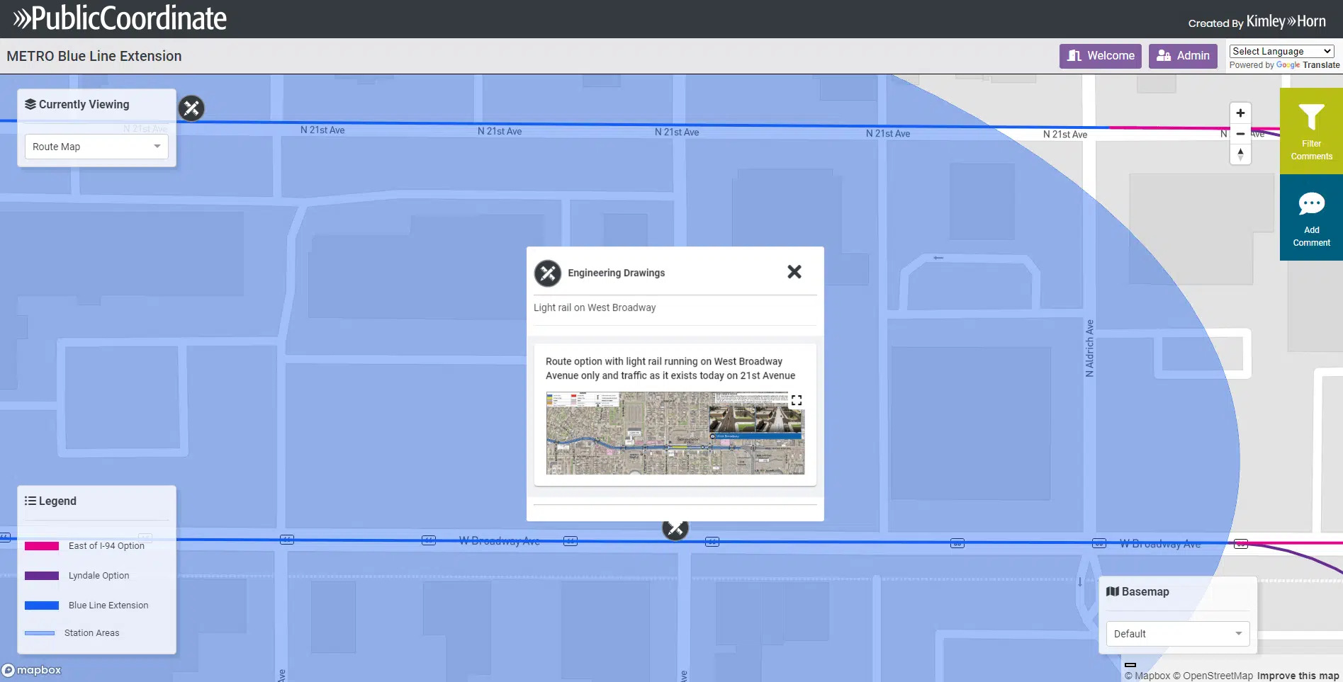
PublicCoordinate, an online community engagement platform, enabled the Metropolitan Council to illustrate project information and receive community feedback in an easily accessible way.
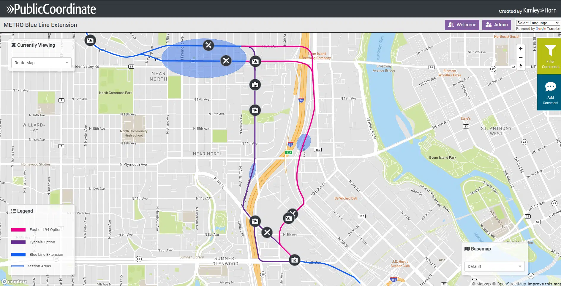
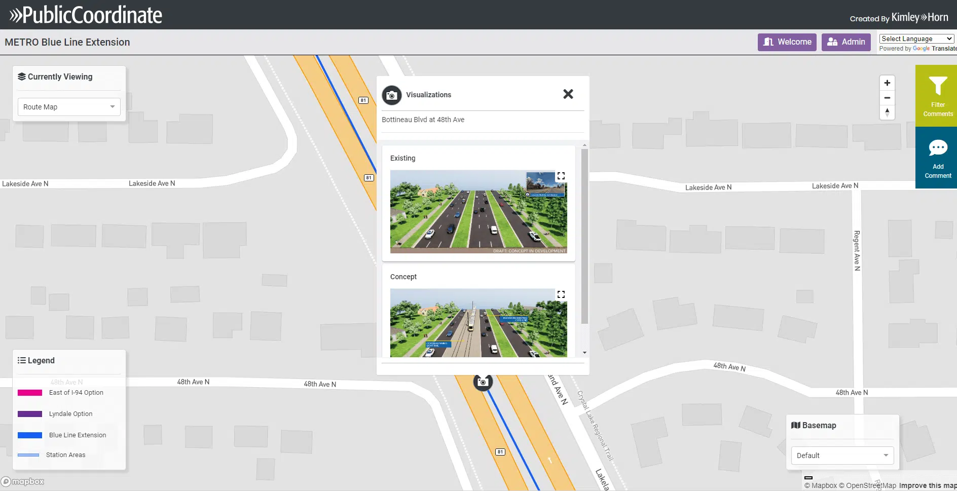
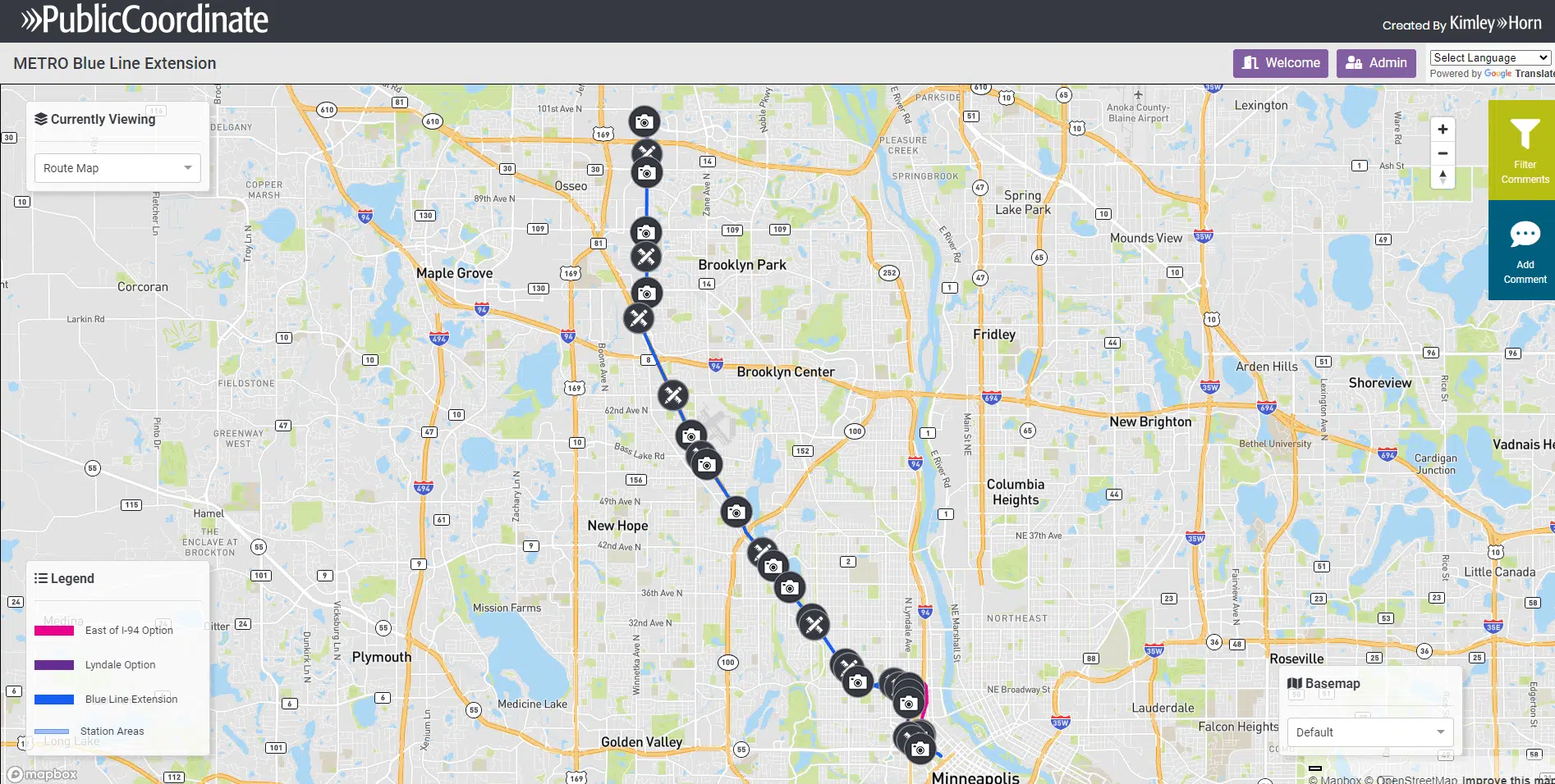
Although the client considered using other third-party platforms, the Metropolitan Council liked the innovative features that PublicCoordinate offered. These features include the ability to share visualizations of before and after views of the light rail in specific locations, intuitive customization options that meet their web accessibility standards, and dynamic functionality to switch between map views and route alternatives.
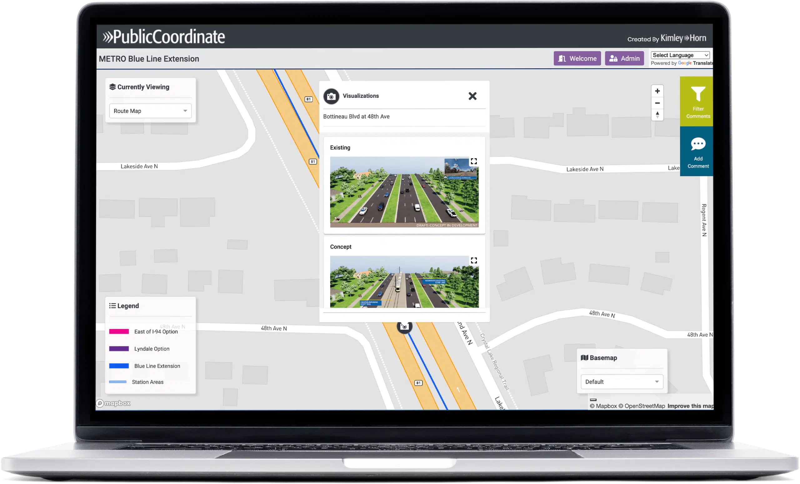
After the Metropolitan Council decided to use PublicCoordinate, the interactive map-based platform provided them with options to share information and collect comments from the community as the project advanced through several phases, allowing the public to trace the effects of their feedback on project decisions over time. The community engagement tool also gave the Metropolitan Council the ability to illustrate location-specific renderings of each proposed route so community members could visualize each route option in their neighborhoods.
Along with promoting public engagement, PublicCoordinate also served as a meaningful tool for the transit design team to use in planning meetings. The team could zoom in and discuss feedback for a specific location along the proposed Blue Line corridor, using visual storytelling to make their stakeholder engagement more effective.
The Impact
PublicCoordinate has been used to solicit public feedback through multiple phases of the Blue Line Light Rail Extension project, providing a transportation planning solution that meets the needs of the community.
The first phase of public engagement launched the initial light rail route options and received over 500 public comments on the interactive map in just two months. For the second phase, the Metropolitan Council wanted to build on their success and requested additional custom functionality, including embedded visualizations showing what the Blue Line route and associated amenities could realistically look like within communities. Although this custom feature was the biggest update PublicCoordinate had ever incorporated, our team accommodated the client’s request and delivered the feature in time to launch the update to the public.
The Metropolitan Council has received positive feedback from the community and project partners about using PublicCoordinate to inform the Blue Line Extension. Since July 2021, the updated maps have received over 2,000 public comments, and that number continues to increase as the map is still active today. Using PublicCoordinate has streamlined the public engagement process for this project, making design and planning for the Blue Line Extension more seamless, efficient, and empowering for the community.
Altogether, multiple iterations of community engagement with approximately 4,000 survey responses integrated within PublicCoordinate informed the advancement of the Blue Line Light Rail Extension project. After using the platform, the Metropolitan Council and Hennepin County have made significant advancements toward a community-supported light rail route with their community members’ voices and needs at the center of transit investment decisions.
Get Started
Submit the form below to get more information about how PublicCoordinate can help your agency make public engagement simple, affordable, and streamlined.