2 mile
four-lane boulevard
Services provided
Landscape architecture, roadway, lift station, drainage
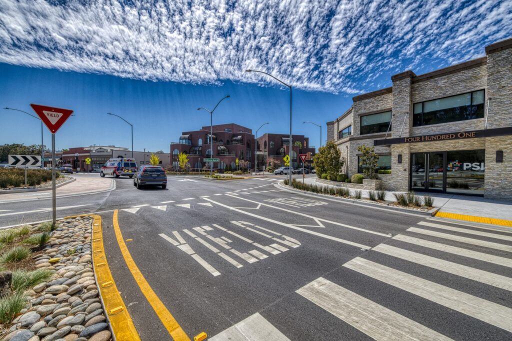
San Jacinto Boulevard began as a new roadway project to connect I-10 to East Cedar Bayou Lynchburg Road and relieve congestion along Garth Road in Baytown, Texas. From the start, the city saw this project as an opportunity to be much more than solely traffic decongesting. Rather, they wanted to provide something that embodied the new vision their residents had for the community.
The city hired Kimley-Horn as the engineer to design the new road, which was intended to provide a few key items to the citizens of Baytown:
- A new north-south four-lane boulevard corridor to the west of Garth Road to relieve traffic from Garth Road
- New, high-quality developable property with an overlay district
- A new standard of roadway design and construction to be used moving forward in the city
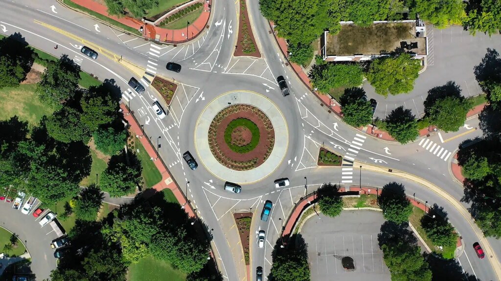
Working with the city, we kept these goals in mind to offer new and creative solutions for improved pavement construction methods and improved landscaping in the medians and parkways to provide a sense of place. The team was also focused on utilizing the opportunity to construct a new roundabout with an art installation that could improve traffic flow while highlighting an historic figure important to the city and its citizens.
As part of this project, the Kimley-Horn team provided the following services:
-
Landscape Architecture
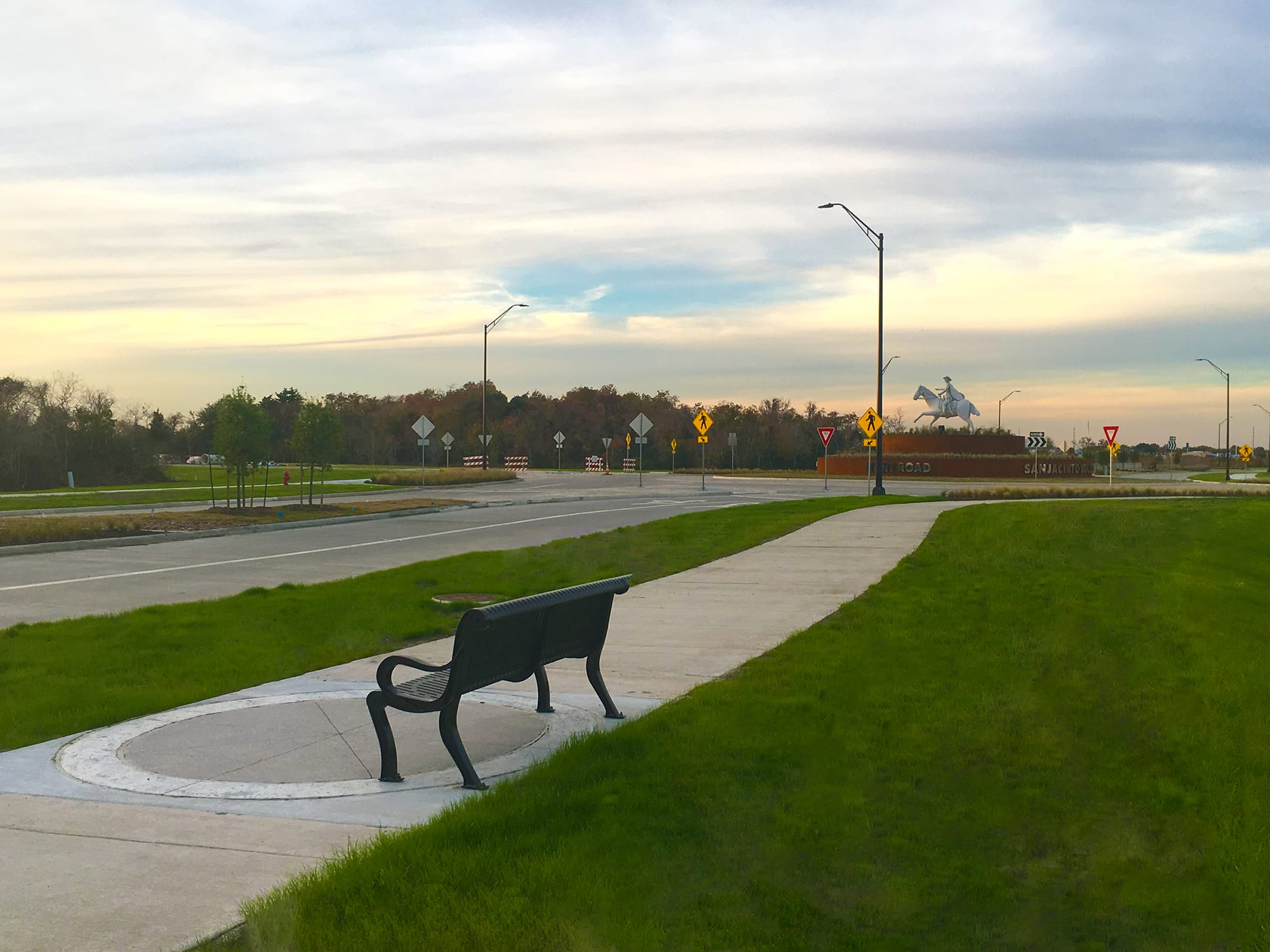
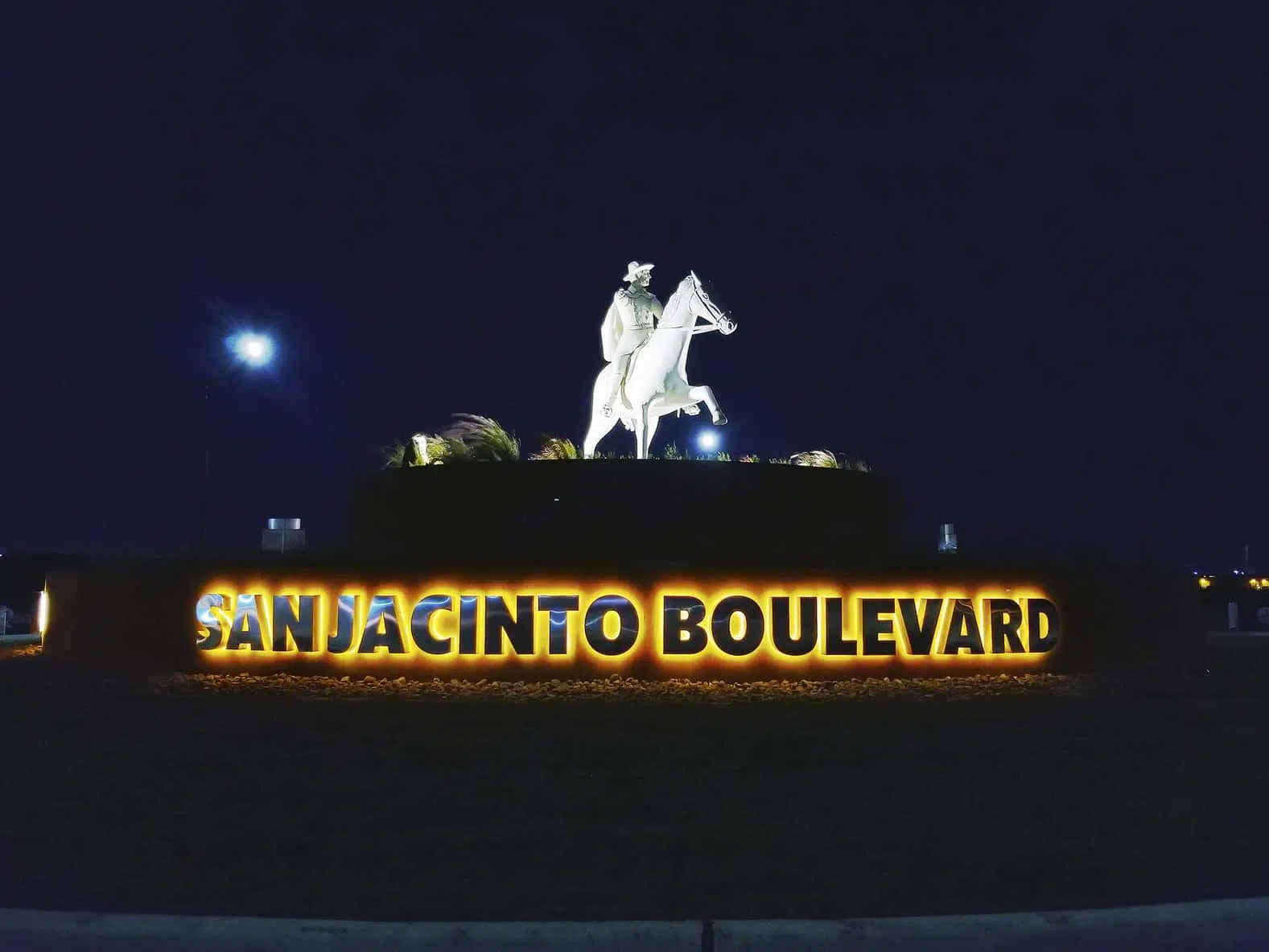
Working together with the Parks and Recreation department, several themes for beautification components came to light: the industrial economy, coastal proximity, and, above all, the historic tie to the Battle of San Jacinto and street namesake. With this direction, the city contacted renown sculptor David Adickes to commission a massive 16-foot-tall public art feature of Sam Houston. Kimley-Horn designed a grand platform and oriented the sculpture so that he points toward the famous battle location.
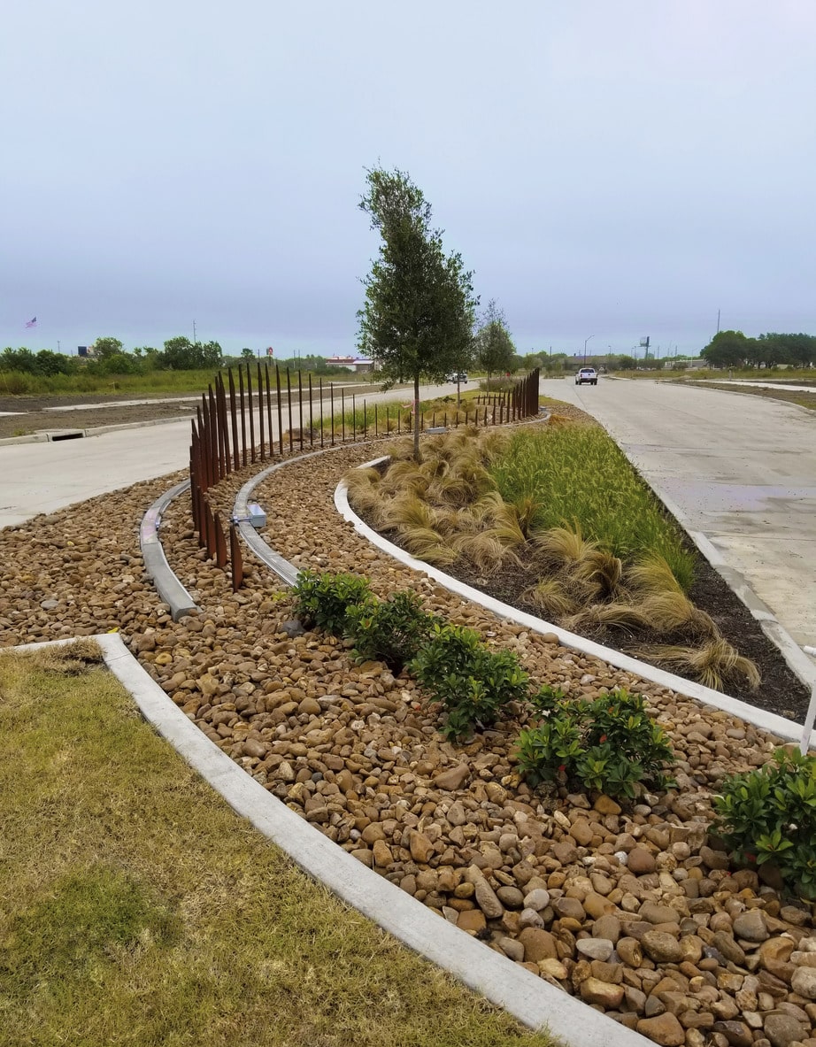
Wave wall art features, enhanced landscape, and upgraded concrete crosswalks were designed within the medians and intersections of the roadway to improve aesthetic appeal. The intent of this design with these materials sought to embrace the industrial and coastal nature of the city. Corten steel pickets form an industrial-looking serpentine wave wall that dynamically move with your perspective. Ornamental grasses and rock surround the wall and move with the breeze, emphasizing the coastal breeze. Finally, integrally colored stamped concrete highlights the crosswalks and median noses, alerting vehicular traffic of pedestrians crossing and slowing traffic.
Additionally, with the new roadway alignment, the Parks and Recreation department saw the opportunity to connect the Goose Creek Trail to the previously disconnected north side of town. The trail system includes a rest stop, a shaded seating area with bike racks, and water fountain. In combination, the public art, trail extension, and aesthetic appeal of the new roadway seek to provide Baytown’s citizens with a new recreation and educational amenity in the city that they can be proud of for years to come.
-
Roadway
The inception of San Jacinto Boulevard began with an alignment study aimed at improving mobility in and around this commercialized area. The four-lane arterial roadway measures just short of two miles in length and is designed to function as a relief route for adjacent thoroughfares as well as usher in a new look for city street improvements. The design includes pavement and subgrade, storm drainage and public utilities, duct bank, dual lane roundabout, and a beautified approach to street landscaping. The roadway storm sewer outfall went into a Harris County Flood Control District channel. In addition, the roadway crossed the channel. Kimley-Horn prepared a No Impact Study submittal to Harris County Flood Control District for the detention design and roadway crossing.
-
Lift Station
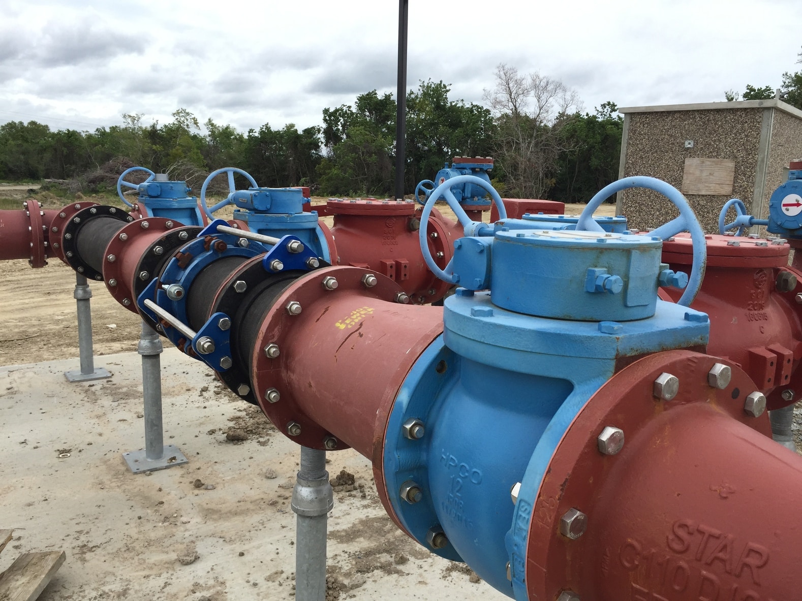
The first step in designing the lift station was to write a Preliminary Engineering Report, identify the service area, and evaluate the existing Goose Creek lift station to determine if any additional flow could contribute to the existing lift station. Kimley-Horn then worked with city staff to determine proposed land uses and projected flow to the station. Since the lift station is in a currently undeveloped area, the submersible lift station was designed to expand from an initial flow rate of 1,080 gpm to 1,780 gpm. An analysis of the force main size resulted in a 12-inch force main that would serve both the initial phase of the lift station and the ultimate pump set up. Lastly, for the expandable submersible pumping set up, Kimley-Horn worked with pump representatives to specify the discharge piping and guide rail set up to allow for the larger pumps to sit in the same pump slots as the smaller pumps. This will allow for a simple expansion with no requirement to take the lift station out of service to access the bottom of the wet well.
-
Drainage
Kimley-Horn designed two detention ponds in XPSWMM to mitigate the increase in peak flow in the channel due to the construction of the roadway improvements. The XPSWMM model included a two-dimensional analysis of the roadway ponding to incorporate the storage effect of inlet ponding during the 100-year event. The detention ponds were designed with multi-stage outlet structures to control peak flow in the 10- and 100-year events. The detention ponds provide 25.9 acre-feet of detention storage. Kimley-Horn also designed a roadway crossing of the Harris County Flood Control District channel using HEC-RAS. The crossing consists of 7-8’x5’ reinforced concrete box culverts designed to pass both the existing and ultimate condition flow without causing any adverse impact to adjacent properties.