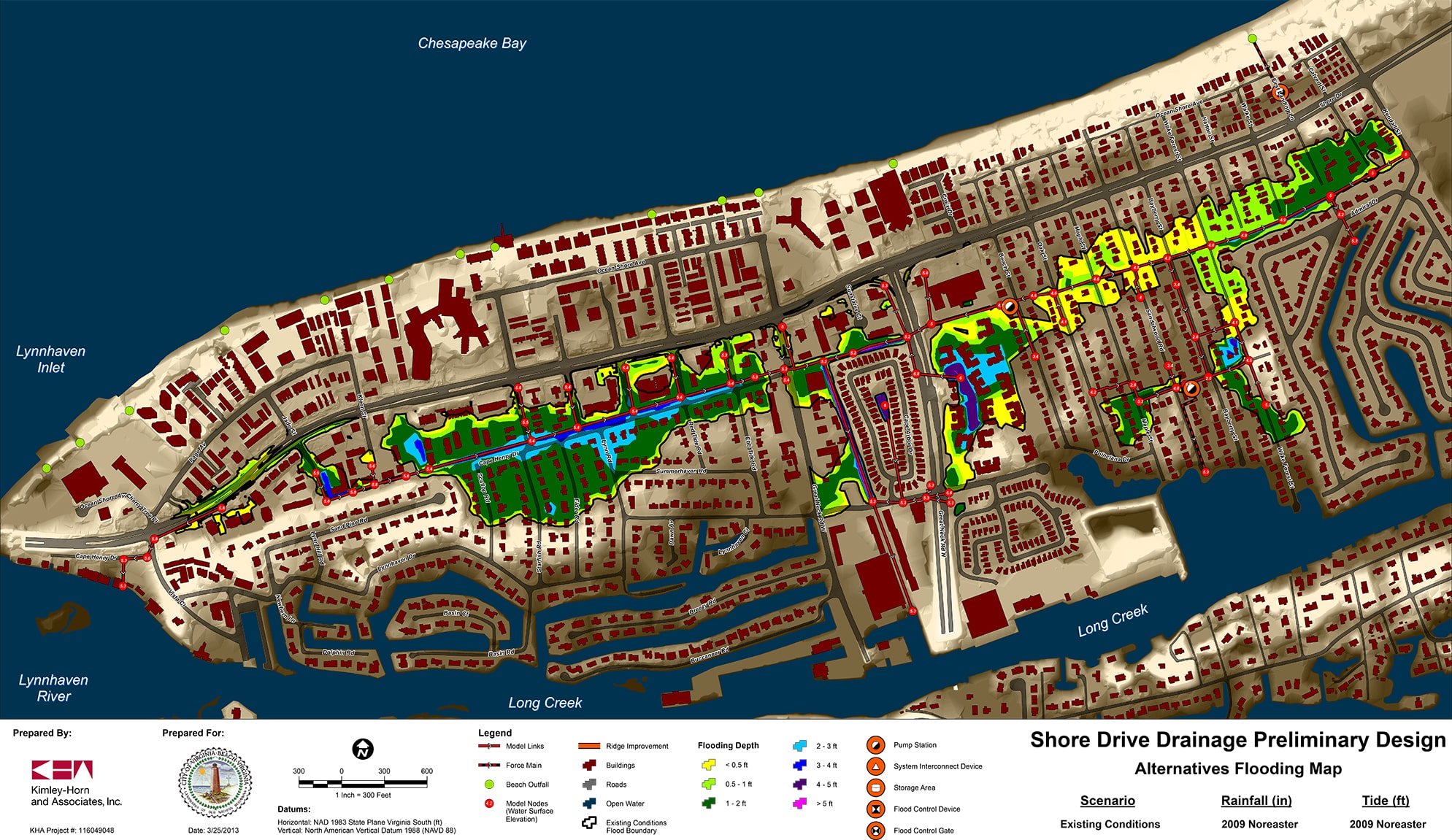
East Shore Drive Flood Control Study
Kimley-Horn conducted a preliminary flood study for the Shore Drive area of Virginia Beach, east of the Lynnhaven Inlet and west of First Landing State Park—a site of chronic flooding from rising sea levels in the Lynnhaven River system.
The primary goal of this study was to determine the most effective options to reduce flooding from both storm surge and rainfall events for the 400-acre project area.
Resilience Assessment and Improvement
Kimley-Horn used the Environmental Protection Agency’s (EPA’s) SWMM hydraulic modeling software to assess the existing stormwater infrastructure and make recommendations for the placement of five stormwater pump stations, storm surge gates, location and size of primary outfalls, options for additional stormwater storage in the Cape Henry Ditch, a major drainage feature serving the area, and culvert upgrades for multiple side streets that cross the Cape Henry Ditch.
Working closely with city staff, Kimley-Horn water resources engineers worked out a phased plan for flood reduction focused on neighborhood-specific improvements. Recommendations for each individual neighborhood were developed based on flooding history and patterns and the existing drainage system.
Utilizing Studies to Create a Plan
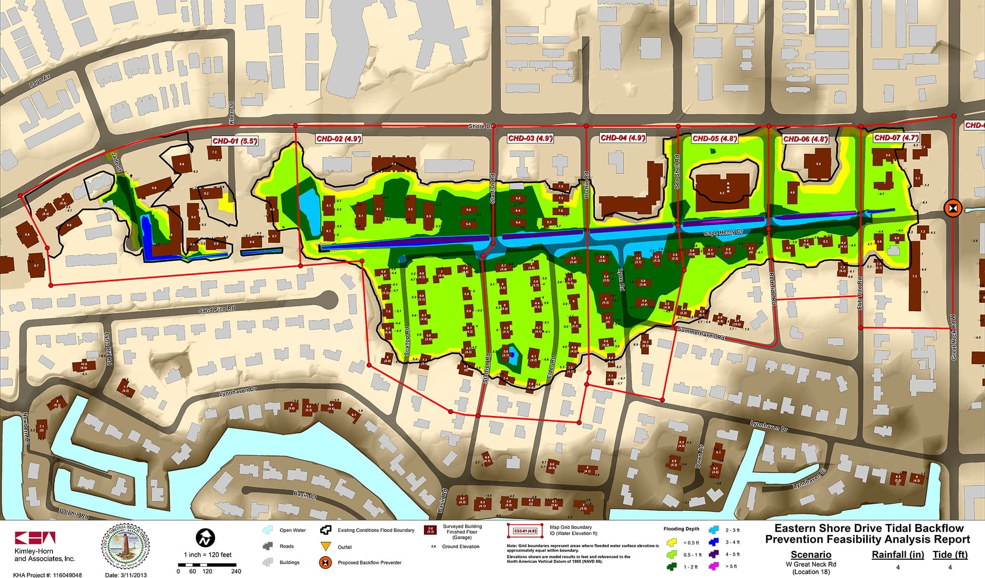
The scope of the study was subsequently amended to evaluate the effectiveness or possible adverse impact of the installation of backflow prevention devices on tidally-influenced stormwater structures within the project area. Kimley-Horn again used the EPA’s SWMM model created in a previous study to model backflow preventers at 20 locations. The team also effectively communicated results to citizens and all community stakeholders.
The final report was accepted by the City of Virginia Beach in 2014.
Related Projects