Becoming Resilient, Episode 5: Resiliency and Water Resources

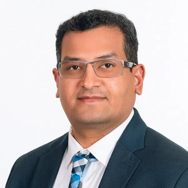
Uday Khambhammettu,
P.E., CFM
Climate Change Planner and Infrastructure Resilience Practitioner

Rama Rani, P.G., GISP
Hydrology & Hydraulics Modeling and Hydrogeology Specialist

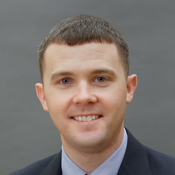
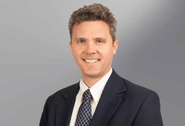
Stephen Thun, P.E., LEED AP
Water Resources Engineer
About This Episode
Host Derek Roessler is once again joined by Uday Khambhamettu, P.E., CFM, as well as two more Kimley-Horn water resource specialists—Rama Rani, P.G., GISP, and Stephen Thun, P.E., LEED AP—to discuss how resiliency plays into water engineering projects, specifically surface water and ground water engineering projects. In this episode, our panelists reflect on their experiences working in Florida and Virginia and talk about what long-term sustainability actions public agencies should be taking right now.
-
Read the Transcript
Derek Roessler: Hello, and welcome back to our Becoming Resilient podcast, focused on Kimley-Horn’s approach to community readiness and resiliency. On today’s episode, we will be diving into the question of how resiliency plays into our water engineering projects. Specifically, our surface water and groundwater engineering projects. We are once again, chatting with Uday Khambhammettu, a water resources engineer and a climate change preparedness specialist from our Virginia Beach office. Uday is joined by two other Kimley-Horn water resource specialists. First up is Rama Rani, an expert in the field of hydrology and hydraulics. Rama sits in our Orlando office and has been in the industry for more than 20 years. Rounding out our panel today is Stephen Thun from our Virginia Beach office. Stephen has spent his 13-year career at Kimley-Horn specializing in the design and construction of stormwater management systems and facilities. Happy to have you all here. Let’s get started. Uday, I’ll start with you.
How does resiliency play into infrastructure planning from a water resources standpoint?
Uday Khambhammettu: Hello Derek, it’s good to be back on the podcast. To answer your question, now more than ever before, our infrastructure is under tremendous stress due to extreme weather-related events. Be it the fires in California and Oregon happening due to extreme dry weather or sudden temperature drops in Colorado, the increased frequency of hurricanes in the Atlantic, and as we speak, hurricane Sally is about to hit Gulf Coast and the increased in fall intensities and frequency of flooding and storm surge. If we set aside the cause of these extreme events, we can all agree that the regularity of these events have increased and the data from the past few decades has only shown that these patterns have been emerging, that the extreme weather events are growing in intensity. They are here to stay and will only get worse, or at least that’s what the data is showing. And compounding the challenge as we discussed in episode one, our infrastructure is already crumbling. The American Society of Civil Engineers have rated our cumulative national infrastructure a D+. When we factor in external stressors like these extreme weather events, the probability of our infrastructure failure is very high. However, having painted that gloomy picture, I do believe that if we put our heads together, we can turn this adversity into an opportunity by building our infrastructure, but then adapt your mindset and make our infrastructure resilient. We won’t have much control over the extreme weather events, but with the resilient infrastructure, we can certainly be prepared to rebound from these events a lot quicker.
Derek: Stephen, how about you?
Stephen Thun: Hey Derek. So just to build on what Uday was saying that when we’re thinking about how to plan and construct more adaptable infrastructure, I’m going to speak a little bit in detail from a drainage perspective. I think it’s adopting a different mindset than would otherwise be applied to stormwater infrastructure design. As drainage engineers, we’re used to designing for the future or built out condition of a watershed, but this is still a static target. And so what’s different about climate change is that it’s a moving target and so we need to adjust our mindset to be more like our partners in the transportation realm when they design a new road or intersection based on future traffic projections, but you still needed to set that target and acknowledge the deviations and the projections and move forward. So, Uday’s going to speak a little bit later to the deviation in climate change projections, but in Virginia Beach specifically, what this means is accounting for between a foot and a half to three feet of sea level rise and a 20% increase in the NOAA Atlas 14 rainfall.
What’s interesting is that accounting for these climate change factors is not just required for new development projects within the city moving forward, but Kimley-Horn is actively working with the City to develop a citywide stormwater master plan that will identify improvements to existing infrastructure that will not only mitigate simulated flooding that occurs under current conditions, but also the flooding that would otherwise occur as a result of climate change. So, this is a very progressive and long-term approach to respond to the impacts of climate change at the municipal level.
Derek: Rama. I’m sure you have some thoughts on this from down in Florida.
Rama Rani: Sure. Traditional risk management methods for water resources generally focus on preventing or absorbing the impact by the system. These methods generally considered one driver at a time which might be climate, hazard, or something else. What this resulted in was underestimation of risk. Unfortunately, the traditional approach exposes new vulnerabilities as the water resource systems now have to not only absorb the impact but have adequate capacity to adapt to unexpected events like climate change or sea level rise. So, looking at water resources from resiliency point of view means looking at a combination of processes would stress our water resources and these processes are generally both spatially and temporally dependent. Now we’ve seen that there’s plenty of evidence that the hydrologic record, which informs water resources management decisions is not stationary. What this means for the future of water resources is that it looks different from what it did in the past, and for infrastructure planning, to be more resilient, the investment must be forward-looking. We’ve seen that temporal and spatial climate patterns are changing, and this means making water sector decisions based on historical records will not be adequate anymore. So, when you need water resource operations for maybe flood protection or drinking water supply, saltwater intrusion, any of these, climate change poses a systemic threat to reliable operations. So additionally, we have non-physical realities like population growth, which also change and challenge the entire water resource landscape. So, what we need is a slight paradigm shift in how we think and how we assess resiliency and risk of water resources and infrastructure, because at the end we want our financial decisions to be both wise and practical.
Derek: Rama, I like what you said about changing how you think in your resiliency work, so I’d like to stick with you on this next question.
According to the experts, it’s important that we preserve natural areas in ecosystems because they stave off the dramatic effects of climate change on water resources, like all of you have alluded to. Rama, what aspects of this challenge are addressed in your resiliency work?
Rama: Thank you, Derek. I’ll focus on a project that we are presently working on: South Florida Water Management District and Kimley-Horn are developing a detailed numerical model for South Miami-Dade County, which provides analysis of the conveyance system, land exchanges extreme events for a period of about 50 years. Our project model domain covers about 550 square miles of urban Miami-Dade. It’s bound by Everglades National Park on the west and Biscayne Bay and Atlantic Ocean on the east. This makes it quite unique. It’s the only metropolitan area in the entire country which is bound by two natural areas. So, if you were to go from west to east, you have the natural area that Everglades National Park, then you have the urban Miami-Dade, and then you have the natural area again, Atlantic Ocean and Biscayne Bay. Because of this unique location, Miami-Dade is considered to be one of the most vulnerable to climate change impacts.
So, the model we are working on for South Miami-Dade for our client, the South Florida Water Management District, the model is a surface and groundwater model. It will be used to assess the flood protection level of service provided by water management infrastructure under both existing and future conditions. Water management system of Miami-Dade is composed of an extensive network of conveyance canals, water control structures, and the drainage component. All of these are designed to ensure how we safely manage during and after stormwater events. The stormwater which results from rainfall events on these watersheds in south Miami-Dade is discharged to the Biscayne Bay. So, the interaction of the coastal and inland hydrology presents many resiliency challenges for climate change and sea level rise. The hydrologic model that we are developing will be used to address these challenges. We’ll analyze the response of the stormwater system in Miami-Dade for a broad range of rainfall, design events, and sea level rise.
Derek: That sounds like you certainly have a lot of work on your hands. Stephen, how about for you?
Stephen: Sure. We have a lot of natural shorelines in Hampton Roads. The impacts of sea level rise are exemplified by retreating marshes, which have a detrimental impact on shoreline erosion. The traditional response to this has been shoreline hardening and offshore breakwaters. However, living shorelines have been gaining a lot of popularity and they can be seen throughout the region here locally. So, planning for sea level rises is somewhat easy when setting the top elevation of offshore breakwaters and living shorelines sills, but what’s not as easy as is providing enough room for future marsh migration. This is difficult due to the valuable real estate that is often at stake, but the only alternative is to, quote unquote reconstruct the natural areas when the rising seas dictate that that’s required. This presents a delicate balance that needs to be considered by the owner and in the earliest stages of the design and permitting process and something that we’ve helped our clients work through on various local projects here in Virginia Beach.
Derek: With the talk of sea level rise, Rama, I’d like to go back to you on this one.
I’m curious if you could discuss the resiliency of Miami-Dade to both sea level rise and climate changes?
Rama: Happy to talk about it. Miami-Dade has a wide range of challenges. I’ll mention some of them. Extreme events: we know nearly every year there is a probability of the hurricane season bringing on a catastrophic event. We are in hurricane season right now and Sally’s out there. Rising sea levels: the recorded information shows more than 0.3 feet increase of sea level in the last 20 years. So, you can imagine how much stress this causes on the stormwater and the sewer system. And it increases the potential for flooding by overtopping existing seawalls. We have continuous increase in the number of civil infrastructures, which typically result in increased imperviousness, increased stormwater runoff, and increased pollution. Miami-Dade as we know is drained by a system of primary, secondary, and tertiary systems, all of which were designed in the ‘50s. This has been outdated, so it will require or may require control structures or pumping stations to ensure adequate drainage. So how are we helping solve this? South Florida Water Management District and Miami-Dade have undertaken many studies which are designed to increase the resiliency. Miami-Dade County, for example, has updated its stormwater master plan most recently, which includes analyzing land use changes, groundwater changes, extreme events, and potential sea level rise for the next hundred years. The model that South Florida Water Management District and Kimley-Horn are developing right now provides analysis of flood potential for a range of design events like five, 10, 25, and 100-year recurrence intervals. The performance of the system will then be simultaneously analyzed for potential sea level rise changes, considering all the way up to three feet increase of sea levels. So why three feet? Because several studies show that a three feet increase can be expected within the next 50 years.
The result of our model will be used to look at long-term planning objectives for updating canals, water control structure refurbishment, and the increase of capacity, do we need pump stations, where do we need pump stations, anything that will be needed for flood protection level of service and future. Now, if you asked me what all of these studies have in common, it’s retrofitting existing infrastructure and increasing resiliency, not just for near-term, but the long-term future trends as well. All of these studies, they use the most advanced numerical models out there and integrate natural hydrology, climate change, man-made infrastructure to provide understanding of the flood levels, to understand the conveyance requirements and long-term resiliency of this urban area.
Derek: That is certainly a lot to consider. Stephen, I’d like to go up the coast to you.
In your opinion, what are some urban growth challenges that clients can expect?
Stephen: Well Derek, coastal Virginia is measuring sea level rise rates among the top 10% in the nation. In addition to this, Hampton Roads is generally a very densely populated area. And so, specifically in Virginia Beach, it’ll be interesting to see the tactics that are employed by the private sector as redevelopment occurs in these densely populated areas to account for the new requirements associated with climate change that I touched on earlier that we’re evaluating as part of the stormwater master plan. But, I think other local communities are going to follow suit in adopting similar standards. And they’ll be able to use the template that was established by Virginia Beach in terms of public outreach to reach out to the local community, whether it’s local residents or the business sector, and more specifically private development to understand the give and take between the new requirements and the efforts that are going to be required to meet those.
Derek: Uday, how about from you?
Uday: Well, Derek, I concur with what Stephen was just mentioning for this question. I particularly think the challenge is that currently within the United States, about 82% of the total population is in urban areas, and then by 2050, it’s supposed to reach almost 90%. With the increased population comes the demand for housing, transportation, and various amenities, all of which will increase impervious area. So, as Stephen was mentioning, planning for these increased developments is a challenge, but what municipalities can have in place is a standard template to address these urban growth situations. And then with standards, having nature-based solutions can also be required because we cannot wall off ourselves and then just live in bubbles. And so, we need to incorporate nature-based solutions as Stephen was mentioning. Increasing shorelines is another solution that we can have, but it’s easier said than done. And the best way to start implementing these or to address these challenges is by way of adopting some very stringent standards where everybody is held to the same standard.
Derek: With a lot of talk about the challenges that we face, I’d like to end this episode of the podcast on a good note. Stephen, I’ll start with you on this last question.
What are some long-term sustainability actions that clients can start to take?
Stephen: I think the most important thing is to plan now as much as you can using the resources that are available to you. Regional planning organizations and inner governmental agencies play a big role here in coastal Virginia, and they can provide a source of information sharing as well as potential funding assistance. They can also help advocate for your community at the state and federal level, but I think one thing that’s often really overlooked is communication and knowledge sharing at a more organic level between neighboring communities. This is another great opportunity to share resources, share knowledge, and really gain some momentum in terms of resilience planning on a local level.
Derek: Uday, how about for you?
Uday: My suggestion first would be to recognize that investment in resilient infrastructure is essential and the reason why many municipalities shy away from doing that is because of the inherent uncertainty built in predicting these extreme weather events. So, we’ve just got to pick some standard and then move on with it, but then first recognize that investment is needed and an analysis or an evaluation of what that future impact is going to be to the current infrastructure. If an analysis cannot be done internally, hire a consultant to do the infrastructure assessment. Kimley-Horn does quite a lot of these assessments, and we are more than happy to help and . identify the critical infrastructure and their vulnerability to various risk profiles. By various risk profiles, for example, are you trying to mitigate the risk from a 100-year rainfall or 500-year rainfall? And as earlier Rama was talking about, also you would have to define what is a 100-year rainfall or a 500-year rainfall, right, the intensity of it. And then are you preparing for a 1½ -foot or a 3-foot sea level rise or a combination of the rainfall intensities and then sea level rise. To put this in context, what I’m trying to say is if we are trying to protect, say a water treatment plant, you can either build a flood wall that addresses a 500-year rainfall with a three-foot sea level rise, or you could choose only certain processes within this water treatment plant to be hardened, and then the other processes that you probably are okay, even if they are flooded and then it really is not that critical. Then you would have to go through the identification of critical infrastructure, and then what the vulnerability is, and which risks are you okay with managing. Then, prepare a master plan with multiple phases. There is no need to address all vulnerabilities at once, so prioritization is key. And then, also perform a benefit/cost analysis to identify what the potential savings are. In most cases, rather than not, you will find by creating a resilient infrastructure, you would have saved a significant amount than rebuilding that particular infrastructure’s assets.
Derek: Rama, you get the last word on sustainability actions that clients can start to take.
Rama: Cool. I liked what Stephen and Uday said. I’ll just touch on long-term sustainability in the context of urban and natural hydrology and water resources. My suggestion to clients would be to look at it holistically. If you were to evaluate many aspects, look at the long-term changes of hydrologic components that contribute to water budgets. For example, climate change impacts on rainfall and human-induced changes that affect recharge and storage of aquifers or that affect soil retention capacity. How does it change imperviousness? How does it change the water control structure capacities? Then there are long-term changes, caused by growing population like the increased utilization of groundwater, maybe for irrigation, recreation, potable water, increased impacts on natural resources, and then there’s always human-induced pollution. Green infrastructure is one clients should consider for resilience. It’ll reduce total surface runoff, peak discharge, duration of flow, and so on and so forth. Clients should think about addressing all of these holistically. When you combine the interactions of urban coastal groundwater and surface water hydrology, it gives you a very thorough understanding of the external impacts on the system because of climate change and sea level rise. So, at the end of the assessment, what they would have is a list of required actionable steps that they can take to reduce the external impacts, and that would lead to them being successfully resilient.
Derek: Those all sound great. Thank you all for your insights there and thank you all for listening and joining us for episode five of our Becoming Resilient podcast. Tune in next time when we expand on our conversation today with the discussion on the topic of utilities and how resiliency plays into that market area.
Subscribe on Apple Podcasts
Get notified when our latest episode becomes available.
About the Experts
-
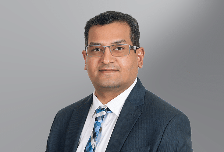
 Uday Khambhammettu P.E., CFMClimate Change Planner and Infrastructure Resilience Practitioner
 -
Uday Khambhammettu P.E., CFMClimate Change Planner and Infrastructure Resilience Practitioner
Uday is a Senior Project Manager in our Virginia Beach, VA office. Based on his more than 16 years of experience in the Civil Engineering industry, Uday believes climate change and resilience will play a crucial role in addressing our aging infrastructure. His work focuses on advising and consulting with various public utilities in preparing their capital improvements projects while integrating adaptive strategies to make the projects resilient and climate-change ready. In addition to resilience work, Uday is a water resource engineer with a primary focus on hydraulic and hydrological modeling. Uday is a 2013 graduate of Water Environment Federation’s Water Leadership Institute and a recipient of Engineering News Record (ENR) Midatlantic’s 2019 Top Young Professionals. Uday earned his Masters in Environmental Engineering from the University of Alabama and Masters of Business Administration from Kenan-Flagler Business School, the University of North Carolina, Chapel Hill. In his free time, Uday enjoys teaching personal resilience, mindfulness, and meditation via various programs offered by a non-profit called Art of Living Foundation.
-
 Rama Rani P.G., GISPHydrology & Hydraulics Modeling and Hydrogeology Specialist
 -
Rama Rani P.G., GISPHydrology & Hydraulics Modeling and Hydrogeology Specialist
Rama has more than 20 years of experience in surface and groundwater modeling. Her project experience includes watershed management, ecosystem restoration, water reservations, water supply, emergency management, and flooding. She has extensive, hands-on modeling experience on regional, sub-regional, and local scale projects covering simple water budgets to detailed, integrated models with a variety of modeling tools. She previously served as the technical lead of the South Florida Water Management District’s Emergency Modeling Team, assisting the agency with operational decision-making during emergencies. Rama has conducted complex hydrologic site investigations to determine the extent and causes of flooding and sources of contamination; she has led oversight of field activities related to contaminant investigations. She also acquired extensive experience with GIS applications for spatial analysis, pre- and post-processing of models and data visualization.
-
 Stephen Thun P.E., LEED APWater Resources Engineer
 -
Stephen Thun P.E., LEED APWater Resources Engineer
Stephen specializes in municipal stormwater engineering as a component of resilient infrastructure, including the design of gray infrastructure, green infrastructure, stormwater best management practices (BMPs), BMP retrofits, and stormwater master plans. Stephen is the Kimley-Horn project manager working with the City of Virginia Beach to develop a citywide stormwater master plan that will consider the current and future impacts of climate change to mitigate flooding across the City. Ultimately, the plan will be comprised of 15 drainage basins that cover approximately 500 square miles. Stephen has also been heavily involved in the design and construction of numerous stormwater BMP retrofits throughout coastal Virginia that have been integral to local communities’ plans to comply with Chesapeake Bay Total Maximum Daily Load (TMDL) requirements.


