Expanding Multimodal Connections with the Cross Charlotte Trail
Complex Geography
Structural Design
Connectivity
Part of the City’s plan to invest in multimodal transportation and greater community connection, the Cross Charlotte Trail is poised to be a more than 30-mile network for pedestrians, cyclists, and other travelers. We partnered with the City of Charlotte and Mecklenburg County to design the 1.5-mile trail segment from Brandywine Road to Tyvola Road—considered to be the most complex, expensive, and time-consuming section of the entire trail program.
For this part of the Cross Charlotte Trail project, we provided the following services:
- Civil engineering
- Trail planning & design
- Construction phase services
- Real estate acquisition support
Our team worked with several subconsultants: CES Group Engineers provided survey and base-mapping, Boyle Consulting Engineers worked on geotechnical services, and Hinde Engineering completed utility coordination. Along with the rest of the project team, we also supported community engagement, environmental analysis, and real estate market analysis.

Navigating Unique Project Constraints
Our team connected the trail to a variety of neighborhoods and business areas; however, we discovered that this created challenges with navigating existing utility networks and minimizing impacts to locals.
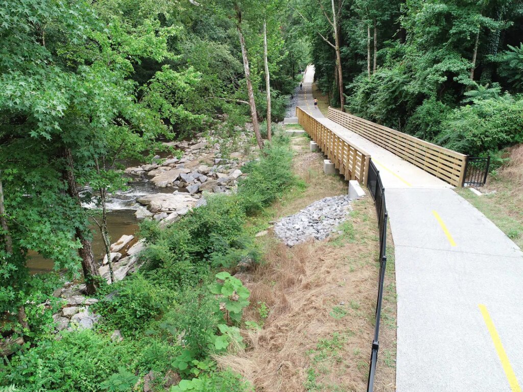
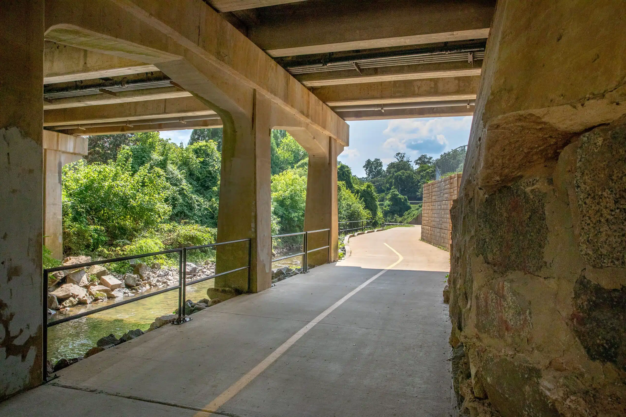
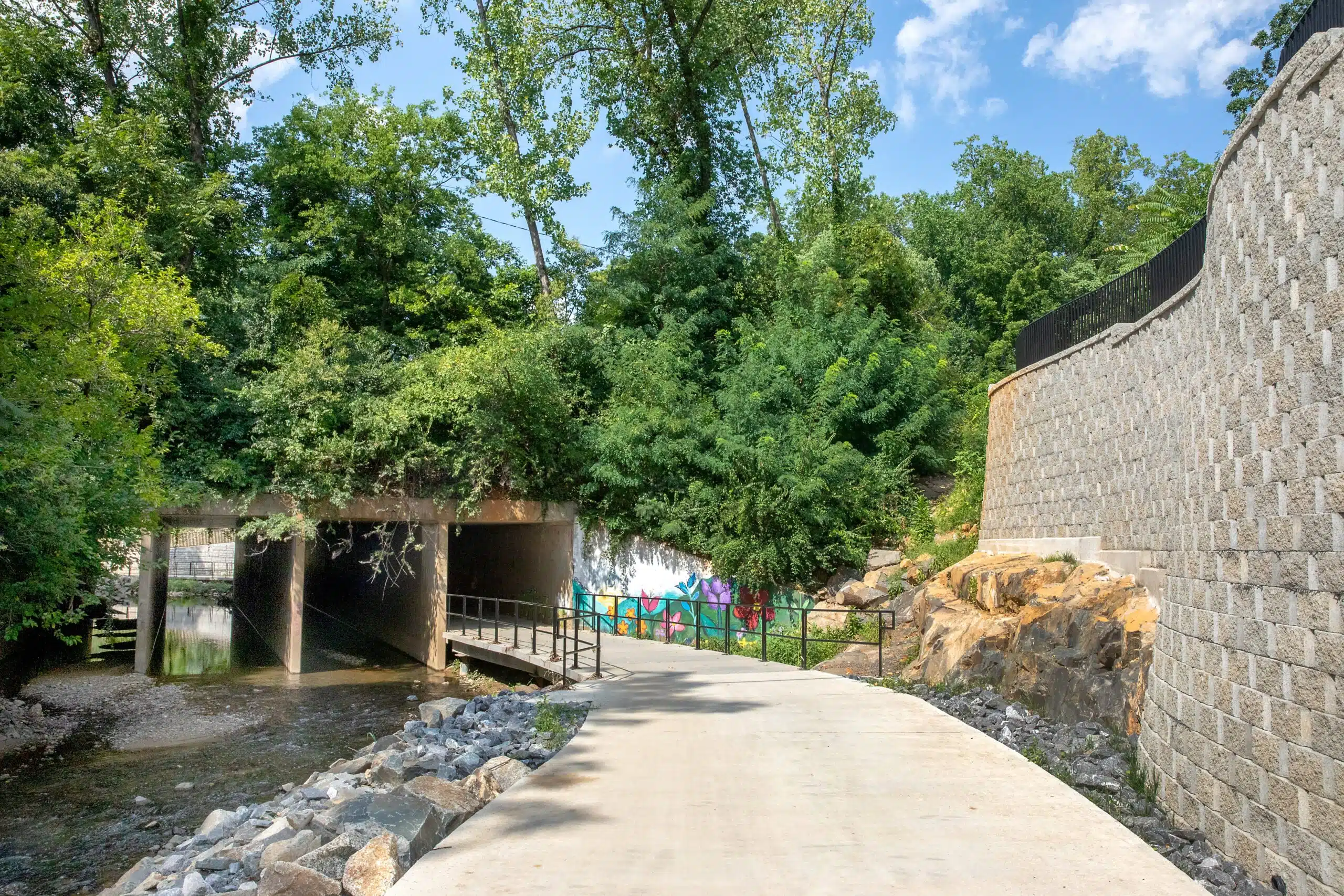
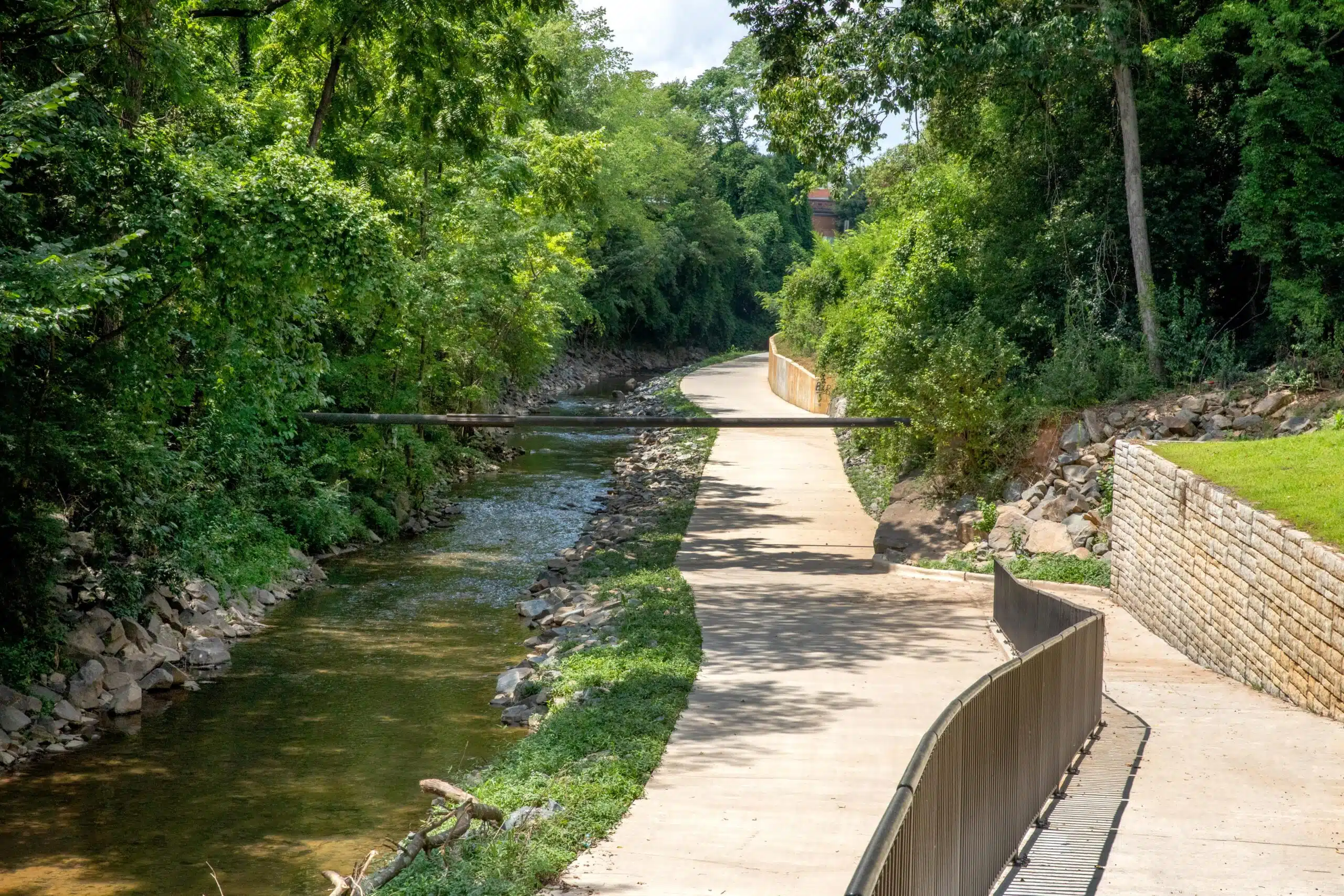
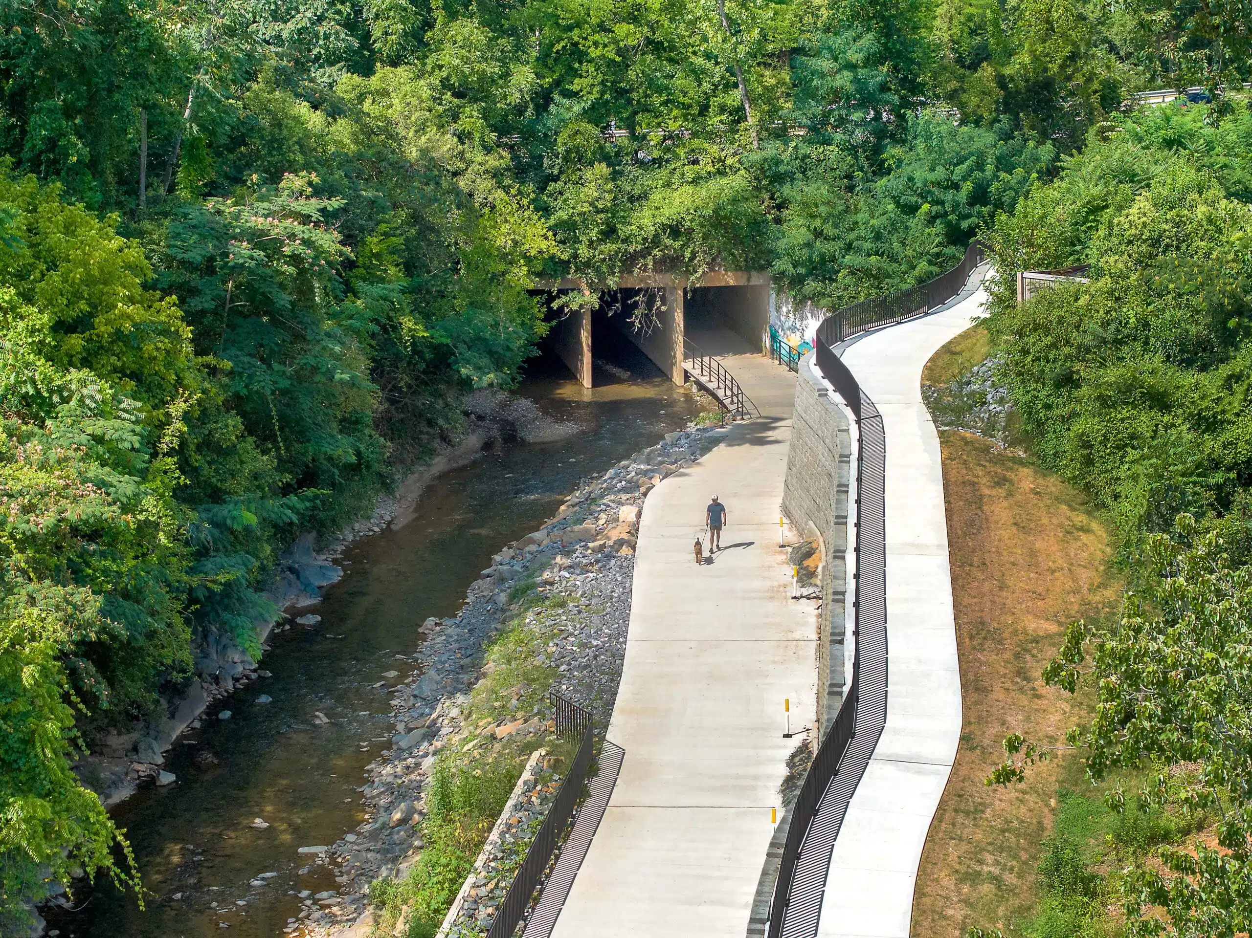
Different areas of the planned trail were intersected by aerial water and sewer lines and underground utility pipes, including a 48-inch water main running under Little Sugar Creek and alongside one of the roadway underpasses. Our team coordinated with Charlotte Water to create a trail alignment that avoided major impacts to this water main. The final design placed trail infrastructure above and beneath the water main so Charlotte Water could easily access it for maintenance.
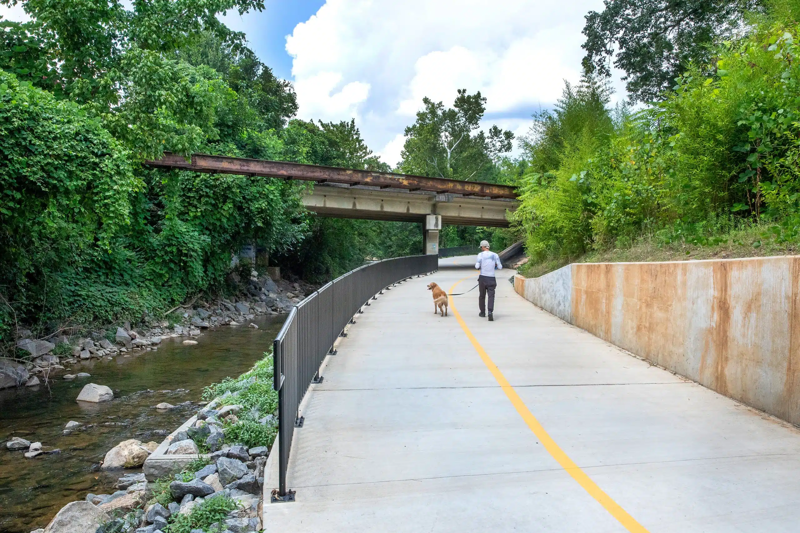
A complicated region of the trail was the Woodlawn Road underpass and the associated four-box culvert. According to North Carolina Department of Transportation (NCDOT) standards, the trail design had to permit base flow through the culvert and allow maintenance access. To align with NCDOT’s needs, we designed a PermaTrak-elevated boardwalk with pre-cast concrete panels mounted to the culvert’s sides and support angles for flexible panel movement.
Designing Diverse Structures Within a Stream Corridor
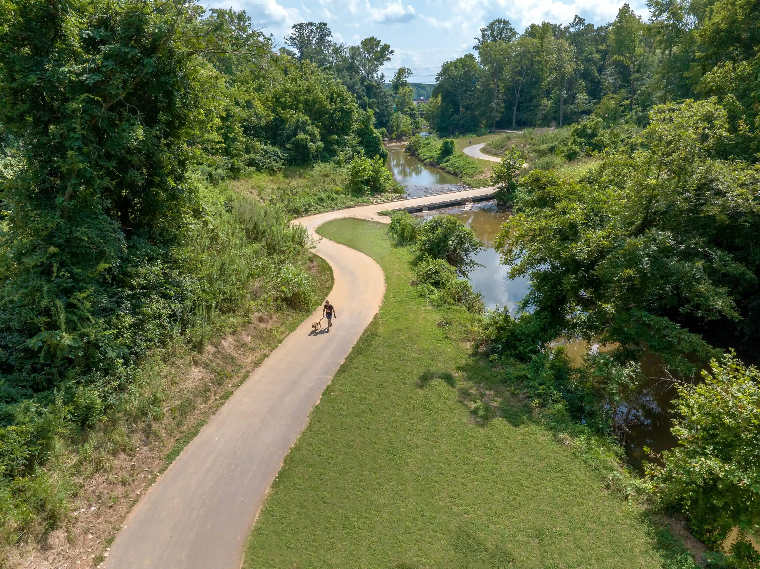
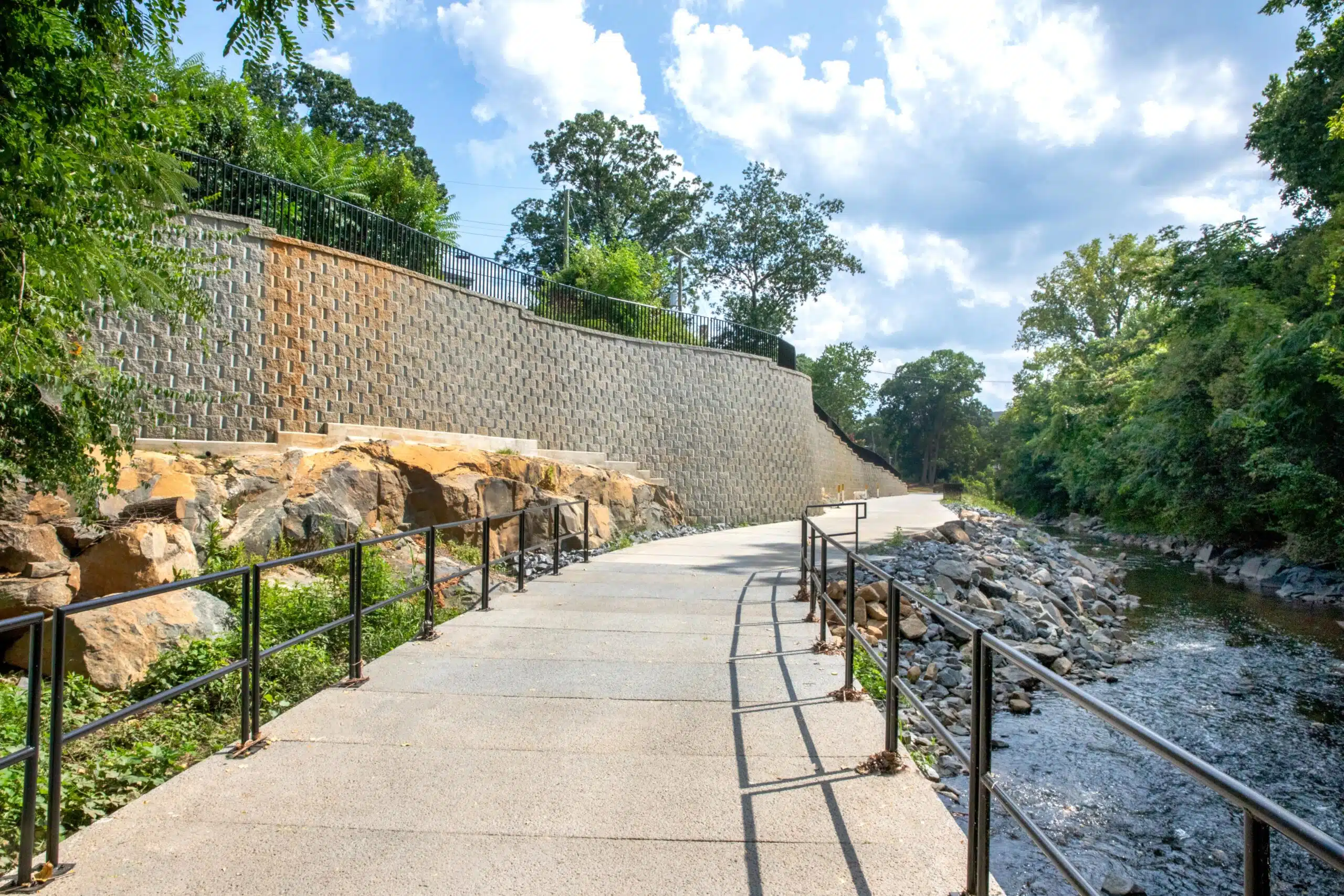
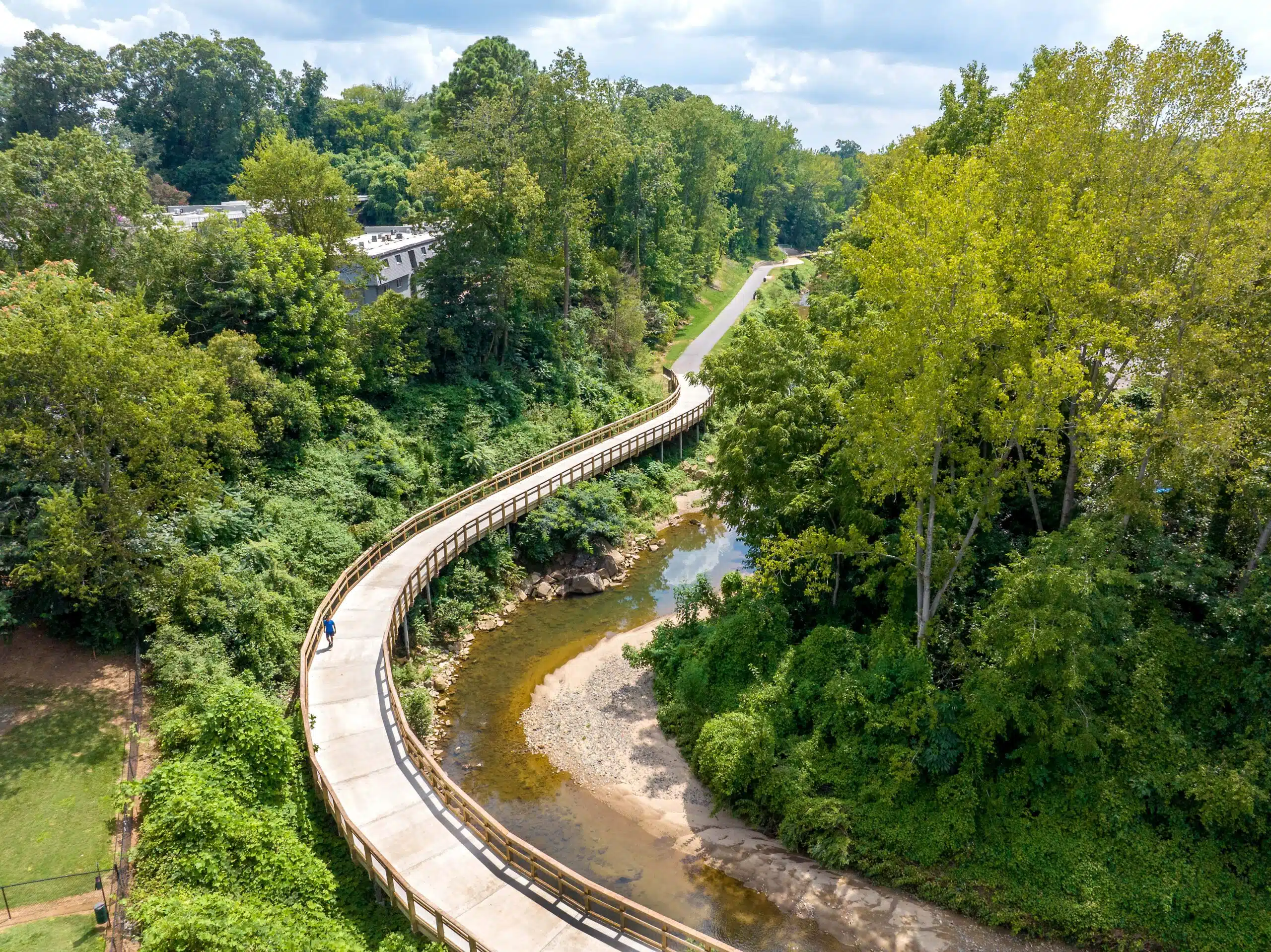
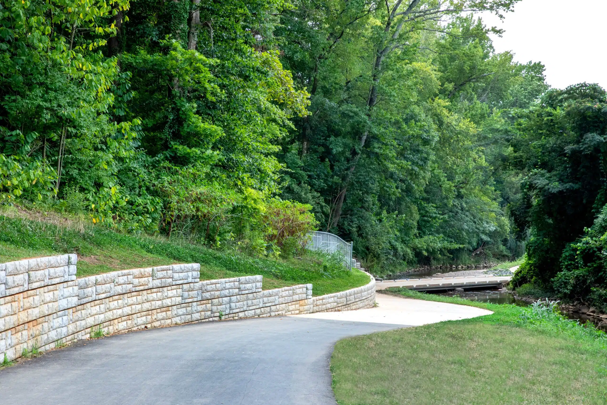
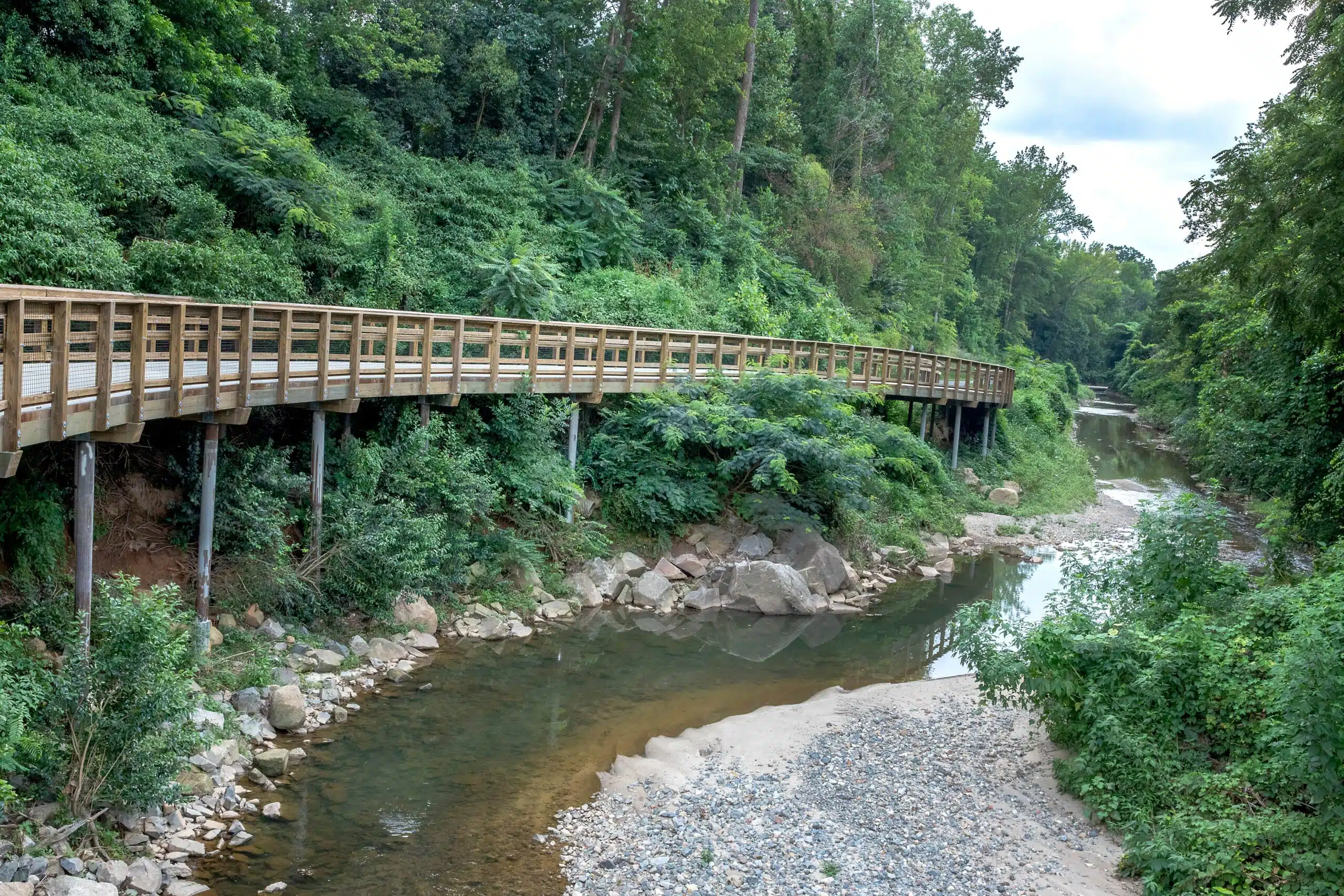
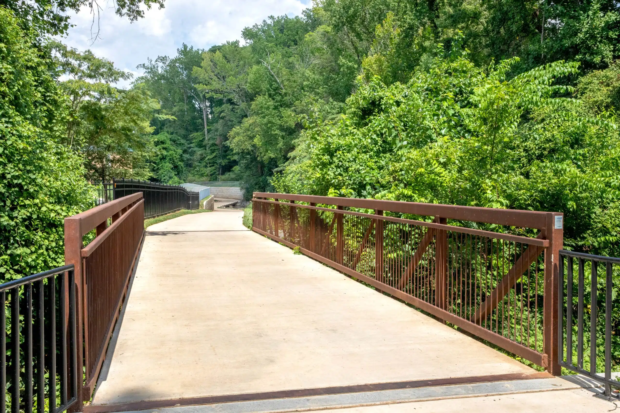
The Cross Charlotte Trail team leveraged a variety of structural designs to provide a stable pathway for travelers. For instance, 25 retaining walls of different heights and styles were created for the Brandywine to Tyvola Road segment. Additionally, a prefabricated pedestrian bridge was added over a Little Sugar Creek tributary.
Geotechnical information was limited in areas, so the team identified places with dense bedrock that needed particularly flexible designs. During construction, we worked with Earth Wall Products to redesign retaining walls to accommodate the bedrock and used rock anchors to support trail infrastructure. Micropile foundations were also used for the three boardwalks to stabilize their height and location around the bedrock.

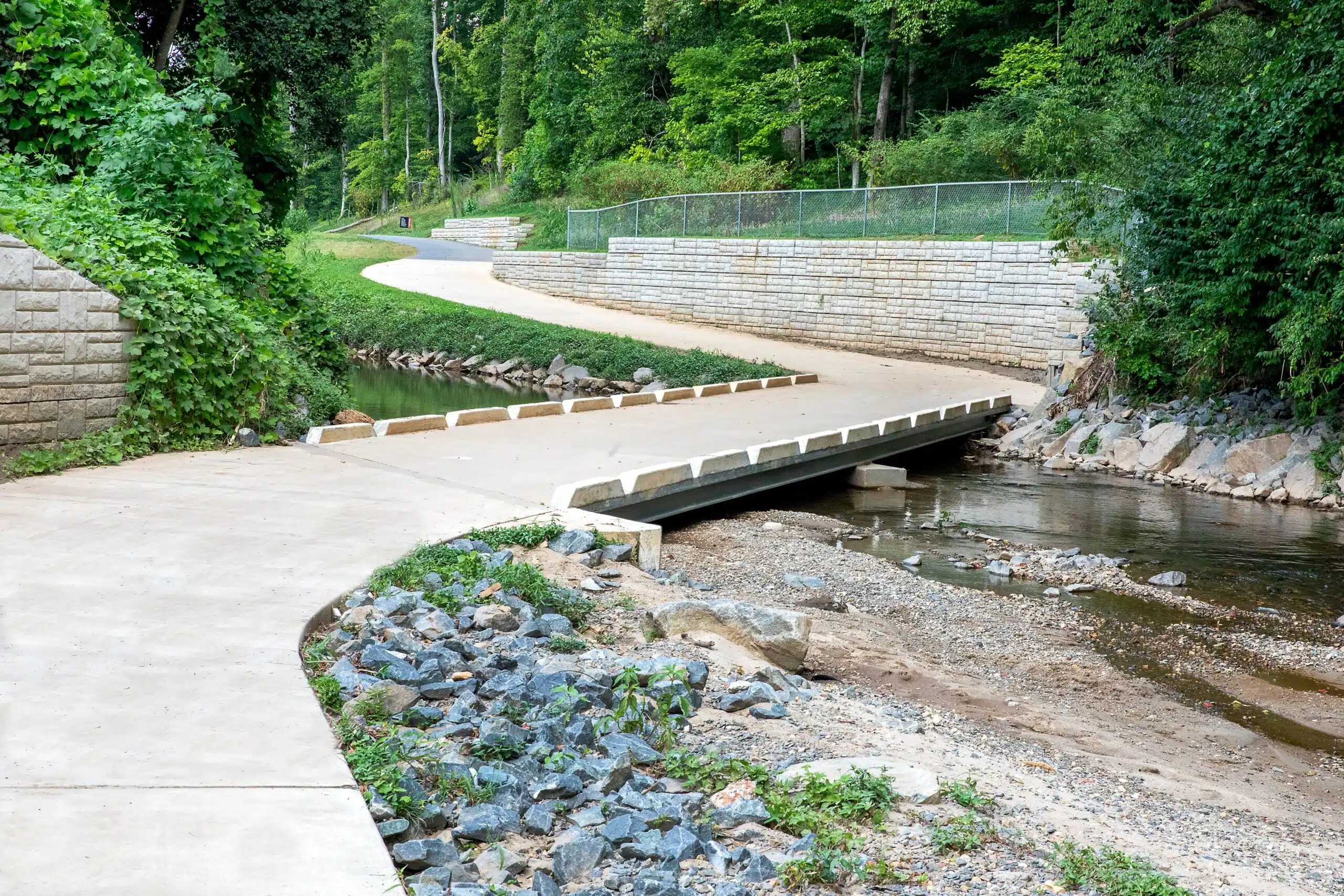
The team also worked through the challenges of placing a 12-foot-wide trail within a floodplain. To understand how water flow could impact surrounding properties, the team completed hydraulic modeling using the Hydrologic Engineering Center’s River Analysis System. After this modeling, we identified a design solution to create four low-water crossings over Little Sugar Creek. These 16-foot-wide and 12-inch-thick cast-in-place concrete bridges with steel beams reduced floodplain mapping impacts and provided a solid, traversable platform.
Additionally, this project needed to align with local riparian/forested buffer requirements—which help to shield bodies of water from destructive human activities and bolster stormwater management. Our team partnered with the City of Charlotte and Mecklenburg County to plant more than 2,000 trees and other forms of vegetation on stream banks to reduce flooding and protect Little Sugar Creek and its tributaries from harm.
Coordinating with Stakeholders for Cost-Effective Permitting
This complex segment of the Cross Charlotte Trail required our team to coordinate extensively with a variety of agencies, including Charlotte-Mecklenburg Stormwater Services, North Carolina Department of Environmental Quality, and Federal Emergency Management Agency—among others. Through our intentional partnerships, permitting efforts, and creative designs, we ultimately saved the City more than $1 million in impact fees.
As of July 2023, the Brandywine to Tyvola Road segment has linked together other parts of the Cross Charlotte Trail—providing 26 miles of pathway (with even more to come). Today, the trail network is used by thousands of people who want a safe, interconnected, and multimodal travel experience on the way to their next adventure.
Project Recognition
- 2024 American Council of Engineering Companies of North Carolina Honors Award, Transportation
- 2024 Engineering News-Record Southeast Merit Award, Landscape/Urban Development
- Engineering & Public Works Roadshow, Connecting Communities: The Cross Charlotte Trail Story
Related Projects