- October 19, 2018
- Perspectives
Connecting Communities: Providing Equitable Access to Urban Refuges

Danielle McCray, P.E.
Transportation Engineer

Cristina Pastore,
P.E., AICP
Traffic Engineer and Transportation Planner

Beth Tucker
Urban Planner and Designer
Danielle McCray, P.E.
Transportation Engineer
Cristina Pastore,
P.E., AICP
Traffic Engineer and Transportation Planner
Beth Tucker
Urban Planner and Designer
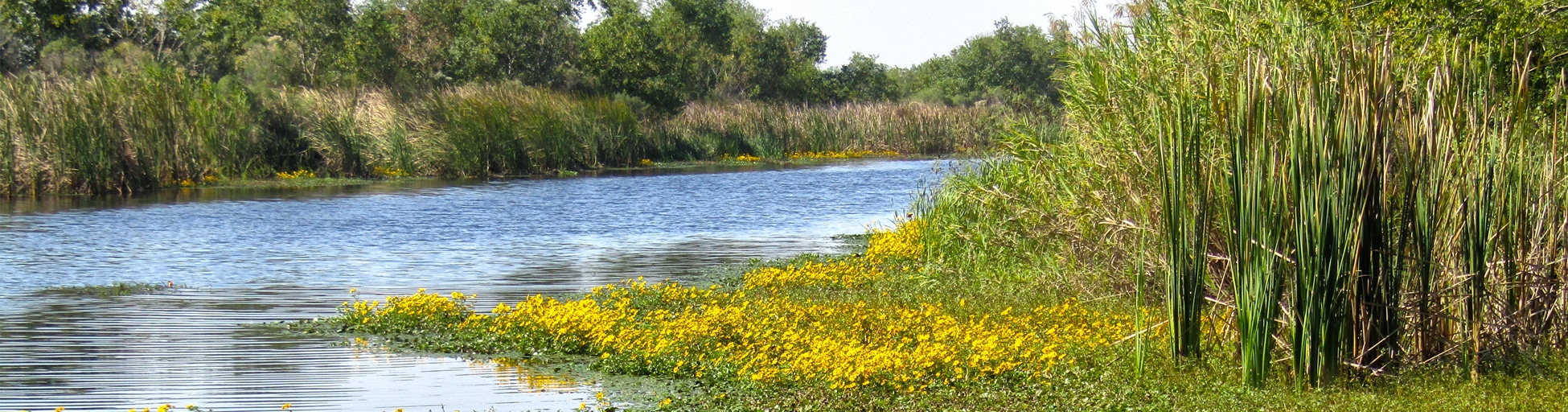
One of the program’s standards, Standard of Excellence 6, is stated to “provide equitable access”—meaning refuges offer accessibility to all people living and working in nearby communities regardless of transportation, physical, or financial limitations. To support the mobility aspect inherent in this standard, FWS launched the Urban Transportation Connections Study, which will develop refuge access plans, increase community awareness, and build an online template to collect projects and data. This nationwide study includes site visits to seven of the 101 urban wildlife refuges: Detroit River (MI), Bayou Sauvage (LA), Santa Ana (TX), Rocky Mountain Arsenal (CO), Occoquan Bay (VA), Steigerwald Lake and Pierce (WA), and San Pablo Bay (CA).
Drawing from their work on this study, Kimley-Horn’s Beth Tucker, Danielle McCray, P.E., and Cristina Pastore, P.E., AICP led a mobile workshop at the 2018 APA National Planning Conference. The workshop taught participants how to leverage one of the refuges, the Bayou Sauvage National Wildlife Refuge in Louisiana, as a case study for evaluating and implementing transportation projects that increase equitable access and community awareness. The team led 50 planners from around the country through a canoeing excursion on the refuge while presenting on the Urban Transportation Connections Study and some of the unique considerations at Bayou Sauvage. Read on to learn more about the team’s experiences.
What aspects did you consider when creating an access plan for Bayou Sauvage?
We wanted to make sure that the refuge, including the programs and events held there, was accessible to all residents of the urban area, particularly to those in underserved or under-represented communities. We learned more about the community by talking to stakeholders and spending extensive time with refuge staff. We discovered that community residents have diverse needs based on their demographics and background. These residents are typically minorities, have limited English proficiency, are below the poverty line, or are under 18. For example, due to limited bicycle and pedestrian connectivity, Bayou Sauvage is nearly impossible to reach without a car, but more than 30% of the New Orleans population doesn’t own or have access to a vehicle. These considerations were included in the refuge access plan for Bayou Sauvage and will shape transportation investments and access projects moving forward.
For all the urban refuges, we want to be sensitive to the cultural and communal needs of the surrounding population, especially because these federal lands are often located near typically disenfranchised communities. For example, Bayou Sauvage is adjacent to a significant population of Vietnamese immigrants. This close-knit community has developed a series of plans for trail connections to the refuge, but currently lacks funding to implement their projects. Our refuge access plans propose building out the trail network to connect the refuge to the Vietnamese community and the nearby city-owned bicycle and pedestrian network.
What educational touchpoints did you identify to increase community awareness of refuges?
Many people don’t know refuges even exist, and if they do, they’re typically not keeping them top of mind. Another concern is that community members from urban environments are unaware of the types of activities that can take place in a refuge beyond viewing nature, hunting, or fishing. The Urban Wildlife Conservation Program is integrating activities that are more applicable to urban communities and developing programs centered on the importance of wildlife and nature in urban settings.
What is the Urban Transportation Template?
After completing refuge site visits, it became even more apparent that the FWS needed a way to collect and maintain information, including demographic and transportation data as well as specific access needs for surrounding communities. To support this need, we’re developing a web-based template that will maintain data available at the national level and enable the refuges to input local-level data in the future. This template, which we’re currently developing with Kimley-Horn’s Software Development team, will serve as the basis for a future tool that will be used to inform transportation planning efforts at all 101 urban refuges. To support template development and generate additional interest in the Urban Transportation Connections Study, our team will join FWS staff at the service’s National Conservation Training Center in Shepherdstown, WV for FWS’s Community Connections Academy. We’ll present the project with our FWS and Federal Highway Administration clients and solicit input from workshop attendees on template functionality.
Why are these equitable access efforts important?
Federal lands need to provide equitable multimodal access for the vitality of both the sites and the local communities. Urban refuges play important roles in communities, providing opportunities for those who live in urban settings to connect with nature. Mitigating barriers to refuge access, such as inadequate transportation options, physical limitations, and financial challenges, is essential for the FWS urban refuges to become valuable community resources.